Höganäs night lights from space
Night Light of Höganäs (Skåne) from space (Sweden) Src. Average luminocity for 10x10km area is 21.2667% and for 50x50km: 8.4843%.
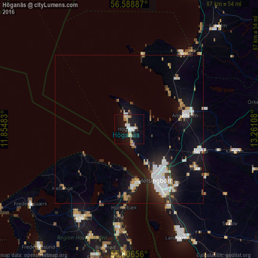
Analysis of Höganäs night lights 2016
Square area 10x10 km:
 4.19%
4.19%90-99
4.67%80-89
4.07%70-79
0.84%60-69
1.91%50-59
1.08%40-49
0%30-39
0.48%20-29
2.03%10-19
29.9%0-9
50.84%Square area 50x50 km:
1.95%90-99
1.75%80-89
0.6%70-79
0.57%60-69
0.76%50-59
0.78%40-49
0.59%30-39
0.8%20-29
1.87%10-19
6.97%0-9
83.36%Clear (daylight) street map image can be seen on geolist.org.
Map coordinates:
56° 35' 19.9" North, 11° 51' 17.4" East
56° 11' 59" North, 12° 33' 28.6" East
55° 48' 23.6" North, 13° 15' 39.9" East
Some cities around Höganäs sort by population:
• Helsingborg
19 km =11.8 mi,  153°
153°
• Helsingør, DK
18.5 km =11.5 mi,  169°
169°
• Ängelholm
19.4 km =12.1 mi,  75°
75°
• Espergærde, DK
22.8 km =14.2 mi,  181°
181°
• Åstorp
25 km =15.5 mi,  106°
106°
• Gilleleje, DK
17.6 km =10.9 mi,  240°
240°
• Hellebæk, DK
14.6 km =9.1 mi, 180°
• Ödåkra
15.8 km =9.8 mi,  132°
132°
2706003 (p: 14,778)
Sources (retrieved 2019-11-25):
» Earth at Night: Flat Maps 2012, 2016