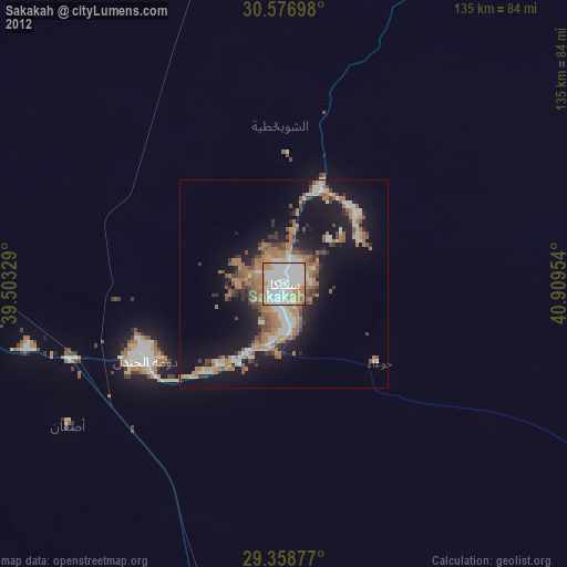
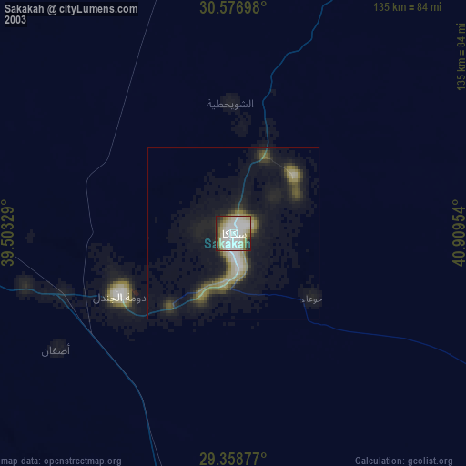
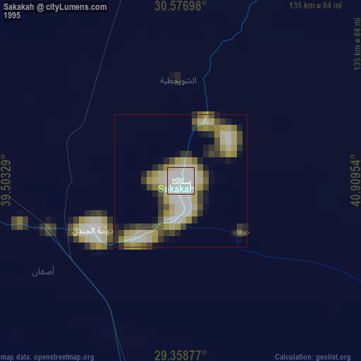
Sakakah night lights from space
Night Light of Sakakah (Al Jawf) from space (Saudi Arabia) Src. Average luminocity for 10x10km area is 92.9659% and for 50x50km: 23.5096%.

Analysis of Sakakah night lights 2016
Square area 10x10 km:
 41.86%
90-99
33.33%80-89
6.63%70-79
11.74%60-69
6.44%50-59
0%40-49
0%30-39
0%20-29
0%10-19
0%0-9
0%Square area 50x50 km:
3.06%90-99
3.46%80-89
1.46%70-79
2.08%60-69
7.65%50-59
3.49%40-49
3.61%30-39
4.85%20-29
6.94%10-19
12.56%0-9
50.84%Clear (daylight) street map image can be seen on geolist.org.
Map coordinates:
30° 34' 37.1" North, 39° 30' 11.8" East
29° 58' 11.1" North, 40° 12' 23.1" East
29° 21' 31.6" North, 40° 54' 34.3" East
Some cities around Sakakah sort by population:
• Ha'il
308.2 km =191.5 mi,  152°
152°
• Arar
137.3 km =85.3 mi,  35°
35°
• Qurayyat
313 km =194.5 mi,  298°
298°
• Turaif
239.9 km =149.1 mi,  322°
322°
• Ţubarjal
200.1 km =124.3 mi,  287°
287°
• Ar Ruţbah, IQ
341.2 km =212 mi,  1°
1°
• Al Azraq ash Shamālī, JO
385.9 km =239.8 mi, 303°
• Şuwayr
24 km =14.9 mi,  47°
47°
102527 (p: 128,332)
Sources (retrieved 2019-11-25):
» NASA, Earths city lights 1995
» NASA city lights 2003
» Earth at Night: Flat Maps 2012, 2016