Ha'il night lights from space
Night Light of Ha'il (Ḩāʼil) from space (Saudi Arabia) Src. Average luminocity for 10x10km area is 98.7083% and for 50x50km: 33.1214%.
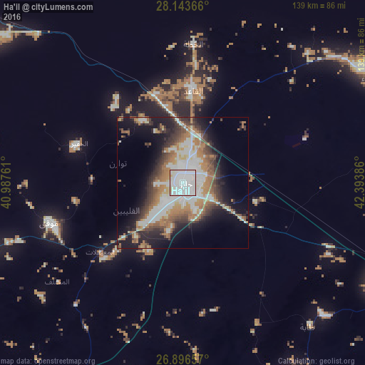
Analysis of Ha'il night lights 2016
Square area 10x10 km:
 81.15%
90-99
13.49%80-89
4.17%70-79
1.19%60-69
0%50-59
0%40-49
0%30-39
0%20-29
0%10-19
0%0-9
0%Square area 50x50 km:
8.69%90-99
6.1%80-89
2.34%70-79
2.87%60-69
7.55%50-59
3.63%40-49
4.11%30-39
5.08%20-29
6.04%10-19
12.23%0-9
41.35%Clear (daylight) street map image can be seen on geolist.org.
Map coordinates:
28° 8' 37.2" North, 40° 59' 15.4" East
27° 31' 18.8" North, 41° 41' 26.6" East
26° 53' 47.7" North, 42° 23' 37.9" East
Some cities around Ha'il sort by population:
• Buraydah
262.6 km =163.2 mi,  120°
120°
• Sakakah
308.2 km =191.5 mi,  332°
332°
• Ar Rass
256.8 km =159.6 mi,  135°
135°
• Al Mithnab
312.1 km =193.9 mi,  126°
126°
• Al Bukayrīyah
248.4 km =154.3 mi, 128°
• Adh Dhibiyah
220.9 km =137.3 mi, 138°
• Tanūmah
245.8 km =152.7 mi,  101°
101°
• Al Fuwayliq
195.7 km =121.6 mi, 127°
106281 (p: 267,005)
Sources (retrieved 2019-11-25):
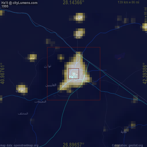
» NASA, Earths city lights 1995
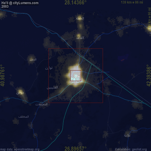
» NASA city lights 2003
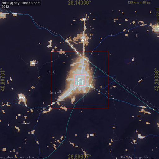
» Earth at Night: Flat Maps 2012, 2016