Yaroslavl night lights from space
Night Light of Yaroslavl (Jaroslavl) from space (Russia) Src. Average luminocity for 10x10km area is 86.6119% and for 50x50km: 10.3652%.
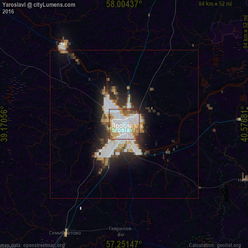
Analysis of Yaroslavl night lights 2016
Square area 10x10 km:
 35.12%
90-99
26.55%80-89
8.93%70-79
10.83%60-69
6.31%50-59
7.02%40-49
2.98%30-39
1.67%20-29
0.6%10-19
0%0-9
0%Square area 50x50 km:
2.75%90-99
2.4%80-89
0.82%70-79
1.02%60-69
1.09%50-59
0.89%40-49
1.01%30-39
1.41%20-29
2.95%10-19
4.29%0-9
81.37%Clear (daylight) street map image can be seen on geolist.org.
Map coordinates:
58° 0' 15.7" North, 39° 10' 14" East
57° 37' 47.5" North, 39° 52' 25.2" East
57° 15' 5.3" North, 40° 34' 36.5" East
Some cities around Yaroslavl sort by population:
• Tutayev
34.6 km =21.5 mi,  325°
325°
• Rostov
56 km =34.8 mi,  209°
209°
• Nerekhta
46 km =28.6 mi,  114°
114°
• Gavrilov-Yam
36.5 km =22.7 mi,  181°
181°
• Semibratovo
41.4 km =25.7 mi, 209°
• Nekrasovskoye
29.7 km =18.5 mi,  79°
79°
• Borisoglebskiy
59.8 km =37.2 mi,  226°
226°
• Konstantinovskiy
27.9 km =17.3 mi,  322°
322°
468902 (p: 606,730)
Sources (retrieved 2019-11-25):
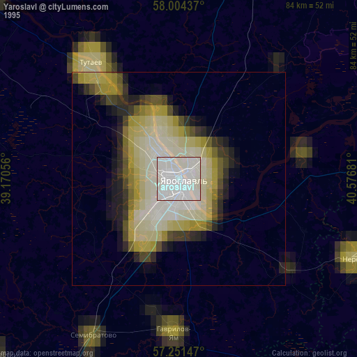
» NASA, Earths city lights 1995
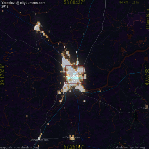
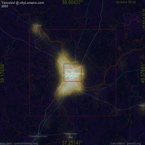
» NASA city lights 2003
» Earth at Night: Flat Maps 2012, 2016