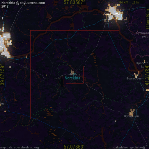
Nerekhta night lights from space
Night Light of Nerekhta (Kostroma Oblast) from space (Russia) Src. Average luminocity for 10x10km area is 1.7739% and for 50x50km: 0.1967%.

Analysis of Nerekhta night lights 2016
Square area 10x10 km:
 0%
0%90-99
0%80-89
0%70-79
0%60-69
0%50-59
0%40-49
2.27%30-39
1.36%20-29
0.45%10-19
0%0-9
95.91%Square area 50x50 km:
0%90-99
0%80-89
0.02%70-79
0%60-69
0.02%50-59
0%40-49
0.12%30-39
0.18%20-29
0.13%10-19
0%0-9
99.54%Clear (daylight) street map image can be seen on geolist.org.
Map coordinates:
57° 50' 6.3" North, 39° 52' 17.7" East
57° 27' 31.7" North, 40° 34' 29" East
57° 4' 43.1" North, 41° 16' 40.2" East
Some cities around Nerekhta sort by population:
• Yaroslavl
46 km =28.6 mi,  294°
294°
• Kostroma
40.1 km =24.9 mi,  31°
31°
• Furmanov
39.3 km =24.4 mi,  125°
125°
• Privolzhsk
43.4 km =27 mi,  100°
100°
• Volgorechensk
34.8 km =21.6 mi,  93°
93°
• Gavrilov-Yam
46.6 km =29 mi,  248°
248°
• Krasnoye-na-Volge
40.2 km =25 mi,  81°
81°
• Nekrasovskoye
27.2 km =16.9 mi,  332°
332°
522594 (p: 25,352)
Sources (retrieved 2019-11-25):
» Earth at Night: Flat Maps 2012, 2016