Spas-Klepiki night lights from space
Night Light of Spas-Klepiki (Ryazan Oblast) from space (Russia) Src. Average luminocity for 10x10km area is 0.8108% and for 50x50km: 0.1705%.
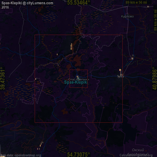
Analysis of Spas-Klepiki night lights 2016
Square area 10x10 km:
 0%
0%90-99
0%80-89
0%70-79
0%60-69
0%50-59
0.5%40-49
0.5%30-39
0%20-29
1%10-19
0%0-9
97.99%Square area 50x50 km:
0%90-99
0%80-89
0%70-79
0.02%60-69
0.02%50-59
0.06%40-49
0.1%30-39
0.06%20-29
0.15%10-19
0%0-9
99.6%Clear (daylight) street map image can be seen on geolist.org.
Map coordinates:
55° 32' 4.7" North, 39° 28' 25" East
55° 8' 5" North, 40° 10' 36.2" East
54° 43' 50.7" North, 40° 52' 47.5" East
Some cities around Spas-Klepiki sort by population:
• Gus’-Khrustal’nyy
60.9 km =37.8 mi,  29°
29°
• Shatura
63.3 km =39.3 mi,  320°
320°
• Roshal’
62.3 km =38.7 mi,  342°
342°
• Rybnoye
61.8 km =38.4 mi,  222°
222°
• Kurlovo
38.5 km =23.9 mi, 30°
• Beloomut
57.4 km =35.7 mi,  248°
248°
• Tuma
24 km =14.9 mi,  86°
86°
• Polyany
51.4 km =31.9 mi,  205°
205°
489862 (p: 5,942)
Sources (retrieved 2019-11-25):
» Earth at Night: Flat Maps 2012, 2016