Polyany night lights from space
Night Light of Polyany (Ryazan Oblast) from space (Russia) Src. Average luminocity for 10x10km area is 1.3346% and for 50x50km: 6.2945%.
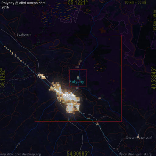
Analysis of Polyany night lights 2016
Square area 10x10 km:
 0%
0%90-99
0%80-89
0%70-79
0%60-69
0%50-59
0.38%40-49
0.13%30-39
0.25%20-29
0.75%10-19
1.5%0-9
96.99%Square area 50x50 km:
1.11%90-99
1.12%80-89
0.82%70-79
0.78%60-69
0.94%50-59
0.73%40-49
0.58%30-39
0.58%20-29
1.94%10-19
3.76%0-9
87.65%Clear (daylight) street map image can be seen on geolist.org.
Map coordinates:
55° 7' 19.6" North, 39° 7' 34.3" East
54° 43' 4.8" North, 39° 49' 45.6" East
54° 18' 35.5" North, 40° 31' 56.8" East
Some cities around Polyany sort by population:
• Ryazan’
13.5 km =8.4 mi,  221°
221°
• Lukhovitsy
57.9 km =36 mi,  299°
299°
• Zaraysk
61.2 km =38 mi,  274°
274°
• Rybnoye
20.1 km =12.5 mi, 273°
• Spassk-Ryazanskiy
49.6 km =30.8 mi,  134°
134°
• Beloomut
40.3 km =25 mi,  308°
308°
• Spas-Klepiki
51.4 km =31.9 mi,  25°
25°
• Starozhilovo
55.1 km =34.2 mi,  174°
174°
506782 (p: 6,170)
Sources (retrieved 2019-11-25):
» Earth at Night: Flat Maps 2012, 2016