Rybatskoye night lights from space
Night Light of Rybatskoye (Leningradskaya Oblast') from space (Russia) Src. Average luminocity for 10x10km area is 90.7004% and for 50x50km: 45.1244%.
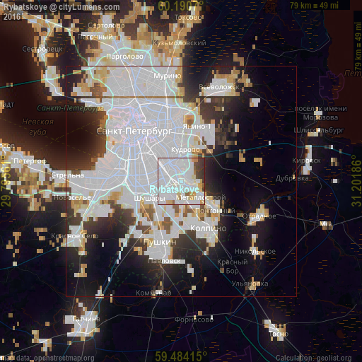
Analysis of Rybatskoye night lights 2016
Square area 10x10 km:
 63.02%
90-99
15.39%80-89
4.86%70-79
4.34%60-69
1.14%50-59
2.27%40-49
3%30-39
4.96%20-29
1.03%10-19
0%0-9
0%Square area 50x50 km:
23.45%90-99
9.11%80-89
2.81%70-79
2.77%60-69
1.7%50-59
1.73%40-49
1.86%30-39
4.27%20-29
6.94%10-19
10.88%0-9
34.47%Clear (daylight) street map image can be seen on geolist.org.
Map coordinates:
60° 11' 26.5" North, 29° 47' 44.2" East
59° 50' 21.5" North, 30° 29' 55.4" East
59° 29' 2.9" North, 31° 12' 6.7" East
Some cities around Rybatskoye sort by population:
• Centralniy
12.8 km =8 mi,  322°
322°
• Kolpino
11.1 km =6.9 mi,  152°
152°
• Kupchino
8.1 km =5 mi,  280°
280°
• Obukhovo
2.7 km =1.7 mi, 280°
• Metallostroy
5.1 km =3.2 mi, 147°
• Shushary
7.4 km =4.6 mi,  242°
242°
• Imeni Sverdlova
10.5 km =6.5 mi,  117°
117°
• Pontonnyy
8.8 km =5.5 mi,  131°
131°
500019 (p: 55,076)
Sources (retrieved 2019-11-25):
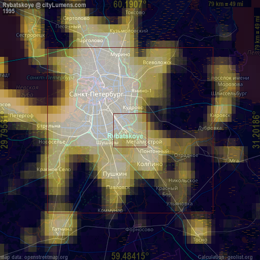
» NASA, Earths city lights 1995
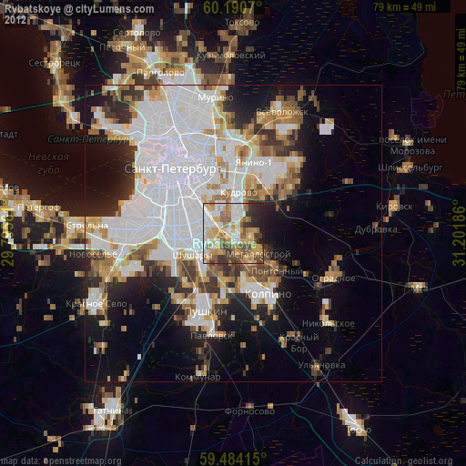
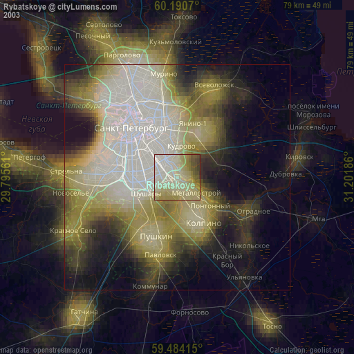
» NASA city lights 2003
» Earth at Night: Flat Maps 2012, 2016