Kolpino night lights from space
Night Light of Kolpino (St.-Petersburg) from space (Russia) Src. Average luminocity for 10x10km area is 63.5487% and for 50x50km: 32.9947%.
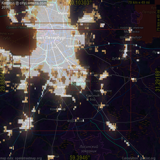
Analysis of Kolpino night lights 2016
Square area 10x10 km:
 19.59%
90-99
20.89%80-89
7.25%70-79
5.52%60-69
0.54%50-59
4.22%40-49
4.87%30-39
8.44%20-29
16.56%10-19
10.28%0-9
1.84%Square area 50x50 km:
17.81%90-99
6.2%80-89
1.83%70-79
1.99%60-69
0.87%50-59
1.25%40-49
1.47%30-39
2.7%20-29
4.62%10-19
8.77%0-9
52.49%Clear (daylight) street map image can be seen on geolist.org.
Map coordinates:
60° 6' 10.9" North, 29° 53' 7.6" East
59° 45' 2.5" North, 30° 35' 18.8" East
59° 23' 40.6" North, 31° 17' 30.1" East
Some cities around Kolpino sort by population:
• Pushkin
11.5 km =7.1 mi,  249°
249°
• Rybatskoye
11.1 km =6.9 mi,  332°
332°
• Obukhovo
12.9 km =8 mi,  323°
323°
• Metallostroy
6 km =3.7 mi,  337°
337°
• Nikol’skoye
12.3 km =7.6 mi,  116°
116°
• Pavlovsk
11.4 km =7.1 mi,  229°
229°
• Imeni Sverdlova
6.6 km =4.1 mi,  40°
40°
• Pontonnyy
4.3 km =2.7 mi,  20°
20°
546105 (p: 138,979)
Sources (retrieved 2019-11-25):
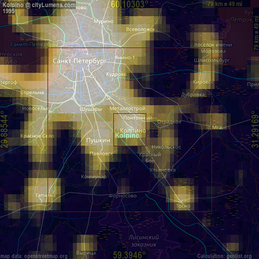
» NASA, Earths city lights 1995
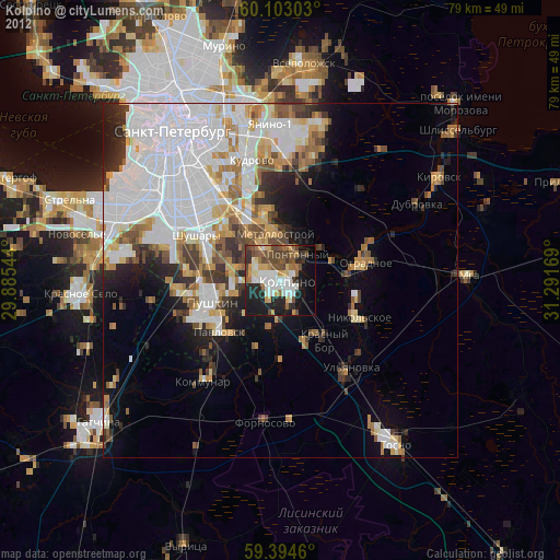
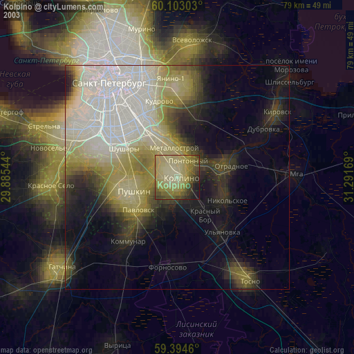
» NASA city lights 2003
» Earth at Night: Flat Maps 2012, 2016