Pontonnyy night lights from space
Night Light of Pontonnyy (St.-Petersburg) from space (Russia) Src. Average luminocity for 10x10km area is 58.5649% and for 50x50km: 35.0972%.
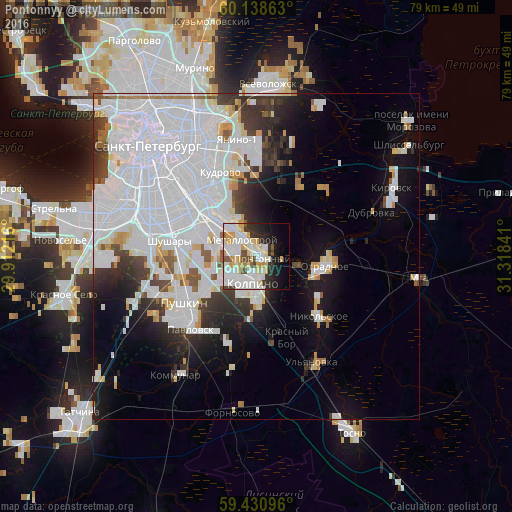
Analysis of Pontonnyy night lights 2016
Square area 10x10 km:
 17.97%
90-99
19.05%80-89
8.77%70-79
6.6%60-69
0.54%50-59
3.03%40-49
4%30-39
3.9%20-29
9.09%10-19
11.8%0-9
15.26%Square area 50x50 km:
19.43%90-99
6.28%80-89
1.94%70-79
2%60-69
1.09%50-59
1.37%40-49
1.59%30-39
3.16%20-29
4.42%10-19
8.22%0-9
50.51%Clear (daylight) street map image can be seen on geolist.org.
Map coordinates:
60° 8' 19.1" North, 29° 54' 43.8" East
59° 47' 12" North, 30° 36' 55" East
59° 25' 51.5" North, 31° 19' 6.3" East
Some cities around Pontonnyy sort by population:
• Kolpino
4.3 km =2.7 mi,  200°
200°
• Rybatskoye
8.8 km =5.5 mi,  311°
311°
• Obukhovo
11.2 km =7 mi,  304°
304°
• Metallostroy
4.1 km =2.5 mi,  292°
292°
• Otradnoye
11.4 km =7.1 mi,  95°
95°
• Nikol’skoye
13.5 km =8.4 mi,  135°
135°
• Shushary
13.3 km =8.3 mi,  280°
280°
• Imeni Sverdlova
3 km =1.9 mi,  69°
69°
506612 (p: 9,001)
Sources (retrieved 2019-11-25):
» Earth at Night: Flat Maps 2012, 2016