Centralniy night lights from space
Night Light of Centralniy (St.-Petersburg) from space (Russia) Src. Average luminocity for 10x10km area is 100% and for 50x50km: 55.064%.
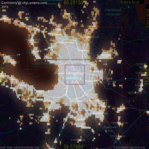
Analysis of Centralniy night lights 2016
Square area 10x10 km:
 100%
100%90-99
0%80-89
0%70-79
0%60-69
0%50-59
0%40-49
0%30-39
0%20-29
0%10-19
0%0-9
0%Square area 50x50 km:
25.13%90-99
11.94%80-89
4.52%70-79
4.63%60-69
3.21%50-59
2.51%40-49
2.51%30-39
5.52%20-29
9.56%10-19
11.8%0-9
18.67%Clear (daylight) street map image can be seen on geolist.org.
Map coordinates:
60° 16' 53.5" North, 29° 39' 27.4" East
59° 55' 52" North, 30° 21' 38.6" East
59° 34' 37" North, 31° 3' 49.9" East
Some cities around Centralniy sort by population:
• Saint Petersburg
2.7 km =1.7 mi,  287°
287°
• Vasyl'evsky Ostrov
6.1 km =3.8 mi,  280°
280°
• Admiralteisky
4.9 km =3 mi,  239°
239°
• Petrogradka
4.7 km =2.9 mi,  324°
324°
• Finlyandskiy
4.1 km =2.5 mi,  2°
2°
• Chernaya Rechka
6.9 km =4.3 mi,  332°
332°
• Sampsonievskiy
6.1 km =3.8 mi,  350°
350°
• Krestovskiy ostrov
7.2 km =4.5 mi,  307°
307°
8504960 (p: 214,625)
Sources (retrieved 2019-11-25):
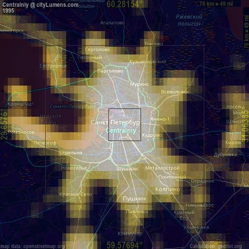
» NASA, Earths city lights 1995
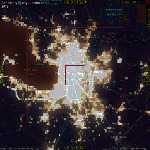
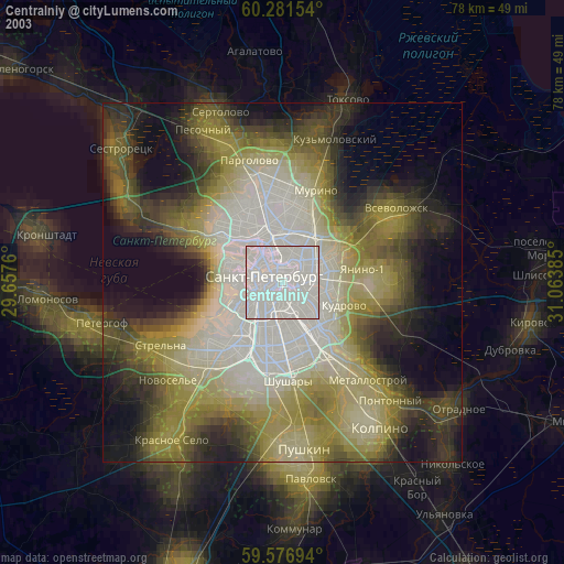
» NASA city lights 2003
» Earth at Night: Flat Maps 2012, 2016