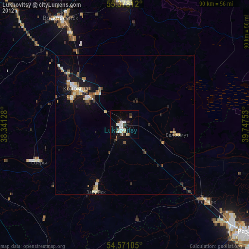
Lukhovitsy night lights from space
Night Light of Lukhovitsy (Moscow Oblast) from space (Russia) Src. Average luminocity for 10x10km area is 15.9809% and for 50x50km: 4.2719%.
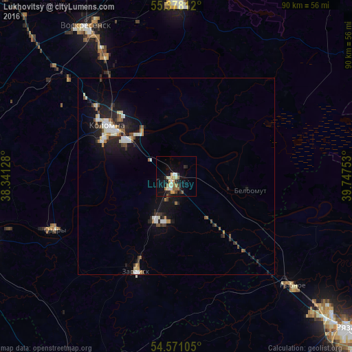
Analysis of Lukhovitsy night lights 2016
Square area 10x10 km:
 1.32%
1.32%90-99
3.35%80-89
2.27%70-79
2.27%60-69
2.03%50-59
1.91%40-49
0.36%30-39
1.08%20-29
3.83%10-19
14.35%0-9
67.22%Square area 50x50 km:
0.58%90-99
0.84%80-89
0.35%70-79
0.37%60-69
0.45%50-59
0.45%40-49
0.48%30-39
0.46%20-29
1.37%10-19
3.84%0-9
90.79%Clear (daylight) street map image can be seen on geolist.org.
Map coordinates:
55° 22' 41.2" North, 38° 20' 28.6" East
54° 58' 35.8" North, 39° 2' 39.8" East
54° 34' 15.8" North, 39° 44' 51.1" East
Some cities around Lukhovitsy sort by population:
• Kolomna
20.5 km =12.7 mi,  303°
303°
• Yegor’yevsk
45.2 km =28.1 mi,  359°
359°
• Voskresensk
45.3 km =28.1 mi,  326°
326°
• Ozëry
34.1 km =21.2 mi,  247°
247°
• Zaraysk
26.3 km =16.3 mi,  203°
203°
• Rybnoye
41 km =25.5 mi,  132°
132°
• Lopatinskiy
45.4 km =28.2 mi, 333°
• Beloomut
19.2 km =11.9 mi,  100°
100°
533543 (p: 32,387)
Sources (retrieved 2019-11-25):
» Earth at Night: Flat Maps 2012, 2016