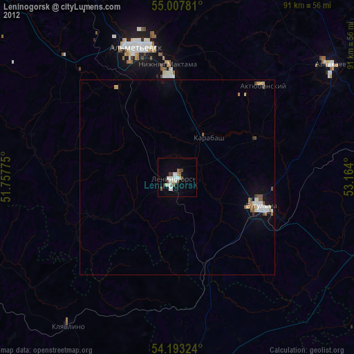
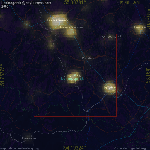
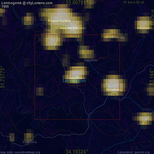
Leninogorsk night lights from space
Night Light of Leninogorsk (Tatarstan Republic) from space (Russia) Src. Average luminocity for 10x10km area is 24.0915% and for 50x50km: 3.243%.
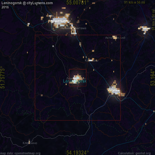
Analysis of Leninogorsk night lights 2016
Square area 10x10 km:
 4.14%
4.14%90-99
5.64%80-89
1.25%70-79
1.63%60-69
4.64%50-59
5.14%40-49
0.63%30-39
0.5%20-29
0.38%10-19
28.45%0-9
47.62%Square area 50x50 km:
0.45%90-99
0.68%80-89
0.26%70-79
0.34%60-69
0.5%50-59
0.45%40-49
0.25%30-39
0.11%20-29
0.51%10-19
2.95%0-9
93.5%Clear (daylight) street map image can be seen on geolist.org.
Map coordinates:
55° 0' 28.1" North, 51° 45' 27.9" East
54° 36' 9.2" North, 52° 27' 39.1" East
54° 11' 35.7" North, 53° 9' 50.4" East
Some cities around Leninogorsk sort by population:
• Al’met’yevsk
34.8 km =21.6 mi,  344°
344°
• Bugul’ma
22.9 km =14.2 mi,  108°
108°
• Bavly
56.6 km =35.2 mi, 114°
• Dzhalil’
50.1 km =31.1 mi,  20°
20°
• Nizhnyaya Maktama
29.1 km =18.1 mi,  355°
355°
• Aktyubinskiy
32.3 km =20.1 mi,  43°
43°
• Klyavlino
46.9 km =29.1 mi,  216°
216°
• Karabash
12.8 km =8 mi, 38°
536162 (p: 66,263)
Sources (retrieved 2019-11-25):
» NASA, Earths city lights 1995
» NASA city lights 2003
» Earth at Night: Flat Maps 2012, 2016