Nizhnyaya Maktama night lights from space
Night Light of Nizhnyaya Maktama (Tatarstan Republic) from space (Russia) Src. Average luminocity for 10x10km area is 25.0801% and for 50x50km: 5.0127%.
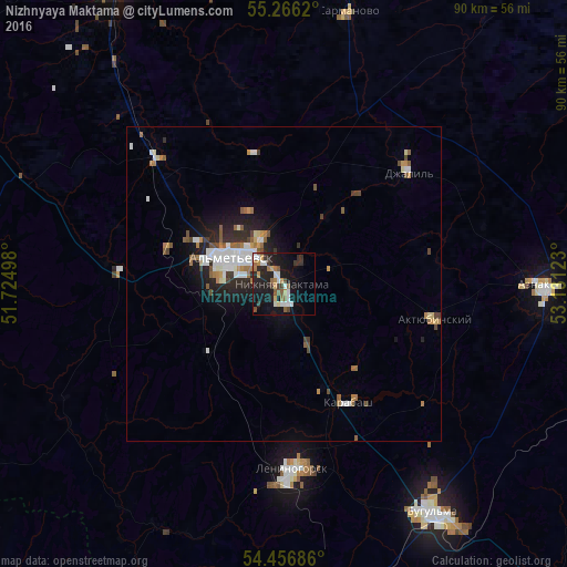
Analysis of Nizhnyaya Maktama night lights 2016
Square area 10x10 km:
 3.59%
3.59%90-99
4.43%80-89
1.44%70-79
2.75%60-69
3.47%50-59
3.95%40-49
1.91%30-39
3.95%20-29
9.81%10-19
26.2%0-9
38.52%Square area 50x50 km:
0.84%90-99
0.99%80-89
0.3%70-79
0.45%60-69
0.7%50-59
0.77%40-49
0.57%30-39
0.48%20-29
1.53%10-19
3.25%0-9
90.12%Clear (daylight) street map image can be seen on geolist.org.
Map coordinates:
55° 15' 58.3" North, 51° 43' 29.9" East
54° 51' 48.8" North, 52° 25' 41.2" East
54° 27' 24.7" North, 53° 7' 52.4" East
Some cities around Nizhnyaya Maktama sort by population:
• Al’met’yevsk
8.5 km =5.3 mi,  302°
302°
• Bugul’ma
43.3 km =26.9 mi,  146°
146°
• Leninogorsk
29.1 km =18.1 mi,  175°
175°
• Zainsk
55.6 km =34.5 mi,  335°
335°
• Dzhalil’
26.5 km =16.5 mi,  47°
47°
• Aktyubinskiy
24.8 km =15.4 mi,  102°
102°
• Sarmanovo
44.7 km =27.8 mi,  13°
13°
• Karabash
21.4 km =13.3 mi, 152°
520318 (p: 10,600)
Sources (retrieved 2019-11-25):
» Earth at Night: Flat Maps 2012, 2016