Aktyubinskiy night lights from space
Night Light of Aktyubinskiy (Tatarstan Republic) from space (Russia) Src. Average luminocity for 10x10km area is 3.7356% and for 50x50km: 2.5474%.
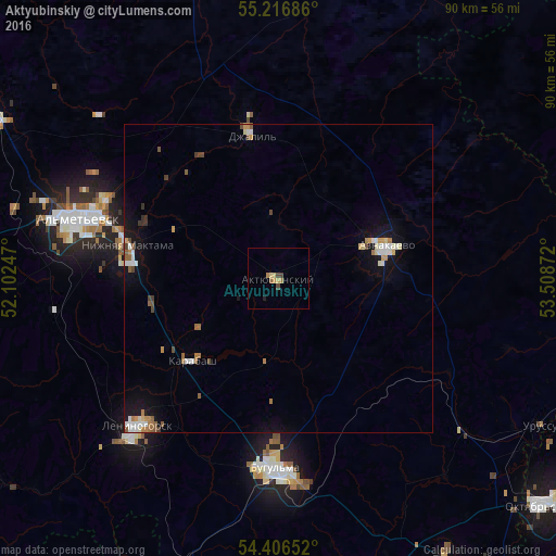
Analysis of Aktyubinskiy night lights 2016
Square area 10x10 km:
 0%
0%90-99
0%80-89
1.2%70-79
0.84%60-69
1.32%50-59
0%40-49
1.32%30-39
0.12%20-29
0.48%10-19
0%0-9
94.74%Square area 50x50 km:
0.35%90-99
0.41%80-89
0.23%70-79
0.34%60-69
0.41%50-59
0.36%40-49
0.32%30-39
0.18%20-29
0.08%10-19
1.88%0-9
95.44%Clear (daylight) street map image can be seen on geolist.org.
Map coordinates:
55° 13' 0.7" North, 52° 6' 8.9" East
54° 48' 49.4" North, 52° 48' 20.1" East
54° 24' 23.5" North, 53° 30' 31.4" East
Some cities around Aktyubinskiy sort by population:
• Al’met’yevsk
33 km =20.5 mi,  287°
287°
• Bugul’ma
30.7 km =19.1 mi,  180°
180°
• Leninogorsk
32.3 km =20.1 mi,  223°
223°
• Dzhalil’
23.8 km =14.8 mi,  349°
349°
• Urussu
48.6 km =30.2 mi,  119°
119°
• Nizhnyaya Maktama
24.8 km =15.4 mi,  282°
282°
• Sarmanovo
51 km =31.7 mi,  344°
344°
• Karabash
19.6 km =12.2 mi,  226°
226°
583548 (p: 9,964)
Sources (retrieved 2019-11-25):
» Earth at Night: Flat Maps 2012, 2016