Krotovka night lights from space
Night Light of Krotovka (Samara Oblast) from space (Russia) Src. Average luminocity for 10x10km area is 9.0657% and for 50x50km: 2.878%.
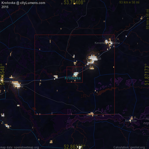
Analysis of Krotovka night lights 2016
Square area 10x10 km:
 1.89%
1.89%90-99
2.4%80-89
0.25%70-79
0.63%60-69
0.38%50-59
0.76%40-49
1.64%30-39
0.63%20-29
0%10-19
0.51%0-9
90.91%Square area 50x50 km:
0.54%90-99
0.61%80-89
0.2%70-79
0.19%60-69
0.28%50-59
0.37%40-49
0.37%30-39
0.22%20-29
0.3%10-19
1.87%0-9
95.07%Clear (daylight) street map image can be seen on geolist.org.
Map coordinates:
53° 42' 14.7" North, 50° 27' 55.7" East
53° 17' 8.9" North, 51° 10' 7" East
52° 51' 48.2" North, 51° 52' 18.2" East
Some cities around Krotovka sort by population:
• Otradnyy
15.4 km =9.6 mi,  49°
49°
• Kinel’
36.5 km =22.7 mi,  259°
259°
• Kinel’-Cherkassy
28.9 km =18 mi,  44°
44°
• Roschinskiy
51.8 km =32.2 mi,  239°
239°
• Borskoye
46.1 km =28.6 mi,  127°
127°
• Bogatoye
27.4 km =17 mi,  156°
156°
• Petra-Dubrava
53.4 km =33.2 mi,  271°
271°
• Smyshlyayevka
52 km =32.3 mi, 264°
540740 (p: 5,398)
Sources (retrieved 2019-11-25):
» Earth at Night: Flat Maps 2012, 2016