Borskoye night lights from space
Night Light of Borskoye (Samara Oblast) from space (Russia) Src. Average luminocity for 10x10km area is 3.0542% and for 50x50km: 0.2077%.
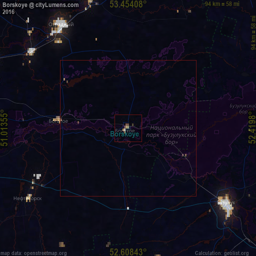
Analysis of Borskoye night lights 2016
Square area 10x10 km:
 0.4%
0.4%90-99
0.13%80-89
0%70-79
0%60-69
1.46%50-59
0.53%40-49
1.19%30-39
1.06%20-29
0%10-19
0%0-9
95.24%Square area 50x50 km:
0.02%90-99
0.01%80-89
0%70-79
0.01%60-69
0.09%50-59
0.04%40-49
0.12%30-39
0.06%20-29
0%10-19
0%0-9
99.66%Clear (daylight) street map image can be seen on geolist.org.
Map coordinates:
53° 27' 14.7" North, 51° 0' 48.8" East
53° 1' 60" North, 51° 43' 0" East
52° 36' 30.3" North, 52° 25' 11.3" East
Some cities around Borskoye sort by population:
• Buzuluk
46.2 km =28.7 mi,  127°
127°
• Otradnyy
45.4 km =28.2 mi,  327°
327°
• Kinel’
75.6 km =47 mi,  286°
286°
• Pokhvistnevo
74 km =46 mi,  21°
21°
• Neftegorsk
45 km =28 mi,  235°
235°
• Kinel’-Cherkassy
51.2 km =31.8 mi,  341°
341°
• Bogatoye
25.9 km =16.1 mi,  276°
276°
• Krotovka
46.1 km =28.6 mi,  307°
307°
571987 (p: 9,119)
Sources (retrieved 2019-11-25):
» Earth at Night: Flat Maps 2012, 2016