Roschinskiy night lights from space
Night Light of Roschinskiy (Samara Oblast) from space (Russia) Src. Average luminocity for 10x10km area is 4.3743% and for 50x50km: 9.915%.
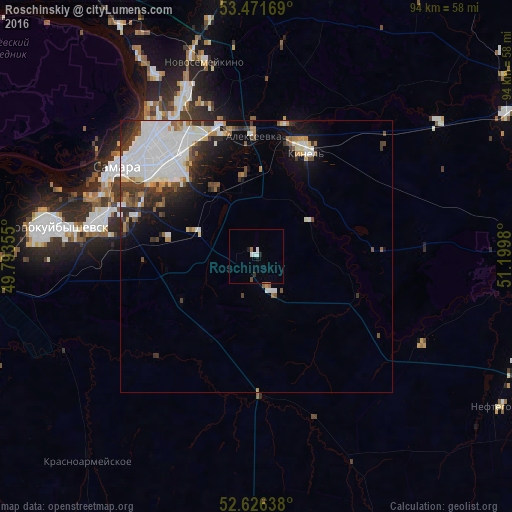
Analysis of Roschinskiy night lights 2016
Square area 10x10 km:
 0.93%
0.93%90-99
1.19%80-89
0%70-79
0%60-69
0.53%50-59
0%40-49
0.53%30-39
0.4%20-29
0.26%10-19
1.46%0-9
94.71%Square area 50x50 km:
3.58%90-99
2.22%80-89
0.6%70-79
0.59%60-69
0.77%50-59
0.73%40-49
0.91%30-39
1.58%20-29
1.74%10-19
3.34%0-9
83.93%Clear (daylight) street map image can be seen on geolist.org.
Map coordinates:
53° 28' 18.1" North, 49° 47' 36.8" East
53° 3' 4" North, 50° 29' 48" East
52° 37' 35" North, 51° 11' 59.3" East
Some cities around Roschinskiy sort by population:
• Samara
28.4 km =17.6 mi,  305°
305°
• Novokuybyshevsk
37.1 km =23.1 mi,  277°
277°
• Kinel’
21.3 km =13.2 mi,  24°
24°
• Novosemeykino
36.8 km =22.9 mi,  345°
345°
• Petra-Dubrava
28.6 km =17.8 mi,  342°
342°
• Smyshlyayevka
22.1 km =13.7 mi, 341°
• Krasnoarmeyskoye
48.3 km =30 mi,  220°
220°
• Rozhdestveno
35.8 km =22.2 mi, 305°
11888186 (p: 10,903)
Sources (retrieved 2019-11-25):
» Earth at Night: Flat Maps 2012, 2016