Kinel’-Cherkassy night lights from space
Night Light of Kinel’-Cherkassy (Samara Oblast) from space (Russia) Src. Average luminocity for 10x10km area is 13.7262% and for 50x50km: 2.6012%.
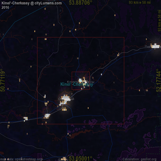
Analysis of Kinel’-Cherkassy night lights 2016
Square area 10x10 km:
 2.38%
2.38%90-99
1.85%80-89
1.85%70-79
1.59%60-69
0.53%50-59
3.04%40-49
1.72%30-39
1.06%20-29
0.79%10-19
5.69%0-9
79.5%Square area 50x50 km:
0.53%90-99
0.51%80-89
0.18%70-79
0.18%60-69
0.26%50-59
0.29%40-49
0.22%30-39
0.2%20-29
0.32%10-19
1.87%0-9
95.43%Clear (daylight) street map image can be seen on geolist.org.
Map coordinates:
53° 53' 13.4" North, 50° 46' 16.3" East
53° 28' 14.2" North, 51° 28' 27.5" East
53° 3' 0" North, 52° 10' 38.8" East
Some cities around Kinel’-Cherkassy sort by population:
• Buguruslan
67.1 km =41.7 mi,  72°
72°
• Otradnyy
13.6 km =8.5 mi,  219°
219°
• Pokhvistnevo
47.6 km =29.6 mi,  64°
64°
• Sukhodol
50.8 km =31.6 mi,  340°
340°
• Borskoye
51.2 km =31.8 mi,  161°
161°
• Krasnyy Yar
71.6 km =44.5 mi,  272°
272°
• Bogatoye
46.6 km =29 mi,  191°
191°
• Krotovka
28.9 km =18 mi, 224°
548622 (p: 18,393)
Sources (retrieved 2019-11-25):
» Earth at Night: Flat Maps 2012, 2016