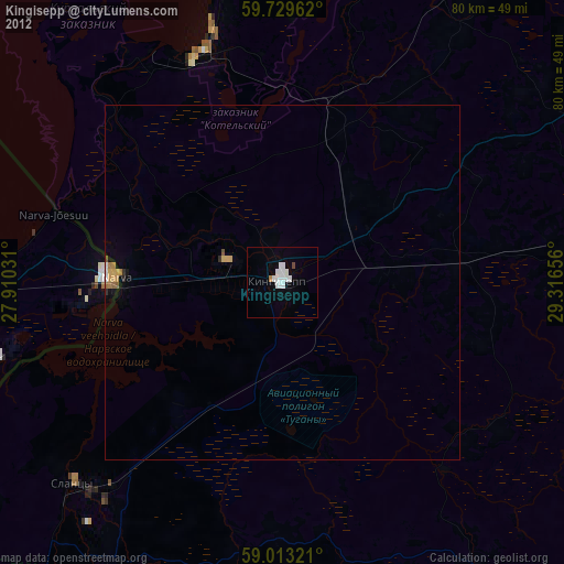
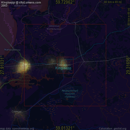
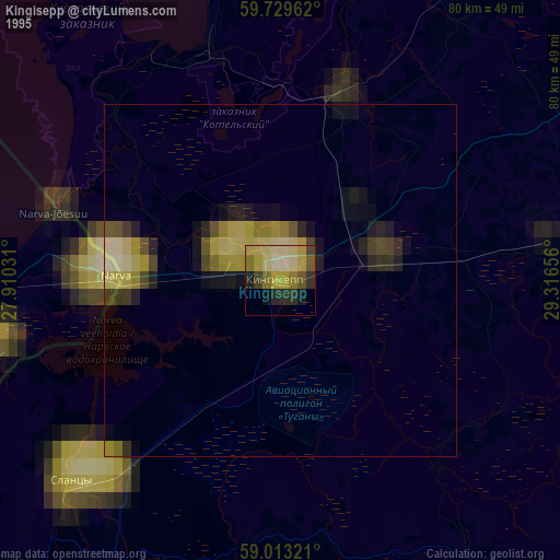
Kingisepp night lights from space
Night Light of Kingisepp (Leningradskaya Oblast') from space (Russia) Src. Average luminocity for 10x10km area is 19.2511% and for 50x50km: 2.5689%.
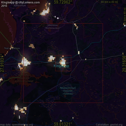
Analysis of Kingisepp night lights 2016
Square area 10x10 km:
 3.68%
3.68%90-99
4.33%80-89
1.08%70-79
1.95%60-69
3.57%50-59
2.06%40-49
0%30-39
0%20-29
0%10-19
23.59%0-9
59.74%Square area 50x50 km:
0.55%90-99
0.62%80-89
0.17%70-79
0.18%60-69
0.25%50-59
0.19%40-49
0.25%30-39
0%20-29
0.24%10-19
2.36%0-9
95.19%Clear (daylight) street map image can be seen on geolist.org.
Map coordinates:
59° 43' 46.6" North, 27° 54' 37.1" East
59° 22' 23.9" North, 28° 36' 48.3" East
59° 0' 47.6" North, 29° 18' 59.6" East
Some cities around Kingisepp sort by population:
• Sosnovyy Bor
64.3 km =40 mi,  24°
24°
• Narva, EE
24 km =14.9 mi,  271°
271°
• Kohtla-Järve, EE
75.9 km =47.2 mi, 272°
• Slantsy
41.1 km =25.5 mi,  226°
226°
• Sillamäe, EE
48.2 km =30 mi, 273°
• Volosovo
50.2 km =31.2 mi,  80°
80°
• Jõhvi, EE
67.6 km =42 mi, 268°
• Ivangorod
22.5 km =14 mi, 269°
548602 (p: 50,566)
Sources (retrieved 2019-11-25):
» NASA, Earths city lights 1995
» NASA city lights 2003
» Earth at Night: Flat Maps 2012, 2016