Kem’ night lights from space
Night Light of Kem’ (Karelia) from space (Russia) Src. Average luminocity for 10x10km area is 9.3755% and for 50x50km: 0.6559%.
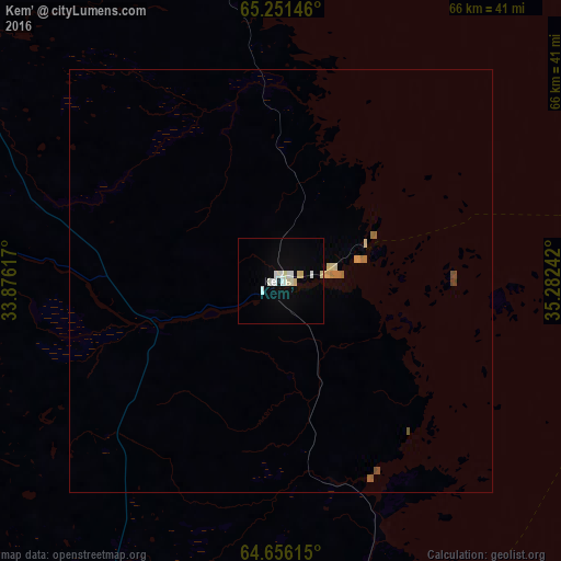
Analysis of Kem’ night lights 2016
Square area 10x10 km:
 1.92%
1.92%90-99
2.93%80-89
2.11%70-79
0%60-69
0%50-59
0%40-49
0%30-39
0%20-29
0%10-19
0.64%0-9
92.4%Square area 50x50 km:
0.08%90-99
0.11%80-89
0.17%70-79
0.04%60-69
0.1%50-59
0.05%40-49
0.08%30-39
0%20-29
0%10-19
0.03%0-9
99.34%Clear (daylight) street map image can be seen on geolist.org.
Map coordinates:
65° 15' 5.3" North, 33° 52' 34.2" East
64° 57' 19.7" North, 34° 34' 45.4" East
64° 39' 22.1" North, 35° 16' 56.7" East
Some cities around Kem’ sort by population:
• Segezha
135.5 km =84.2 mi,  185°
185°
• Kostomuksha
194.5 km =120.9 mi,  257°
257°
• Onega
205.7 km =127.8 mi,  124°
124°
• Belomorsk
48.9 km =30.4 mi,  169°
169°
• Nadvoitsy
121.7 km =75.6 mi, 185°
• Umba
192.8 km =119.8 mi,  356°
356°
• Loukhi
143.2 km =89 mi,  330°
330°
• Kalevala
161.1 km =100.1 mi,  279°
279°
551145 (p: 13,829)
Sources (retrieved 2019-11-25):
» Earth at Night: Flat Maps 2012, 2016