Umba night lights from space
Night Light of Umba (Murmansk) from space (Russia) Src. Average luminocity for 10x10km area is 5.048% and for 50x50km: 0.2068%.
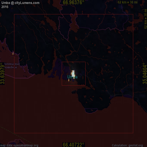
Analysis of Umba night lights 2016
Square area 10x10 km:
 0.84%
0.84%90-99
1.77%80-89
0.08%70-79
0.84%60-69
0.51%50-59
0.34%40-49
0%30-39
0%20-29
0%10-19
0%0-9
95.62%Square area 50x50 km:
0.03%90-99
0.07%80-89
0%70-79
0.03%60-69
0.02%50-59
0.01%40-49
0%30-39
0%20-29
0%10-19
0%0-9
99.82%Clear (daylight) street map image can be seen on geolist.org.
Map coordinates:
66° 57' 49.5" North, 33° 38' 23.2" East
66° 41' 13.4" North, 34° 20' 34.5" East
66° 24' 26" North, 35° 2' 45.7" East
Some cities around Umba sort by population:
• Apatity
105.6 km =65.6 mi,  337°
337°
• Monchegorsk
152.9 km =95 mi, 335°
• Kandalaksha
99.3 km =61.7 mi,  302°
302°
• Kirovsk
107.1 km =66.5 mi, 344°
• Polyarnyye Zori
110 km =68.4 mi,  313°
313°
• Revda
139.3 km =86.6 mi,  3°
3°
• Zelenoborskiy
88.6 km =55.1 mi,  281°
281°
• Loukhi
89.1 km =55.4 mi,  220°
220°
479071 (p: 6,128)
Sources (retrieved 2019-11-25):
» Earth at Night: Flat Maps 2012, 2016