Nadvoitsy night lights from space
Night Light of Nadvoitsy (Karelia) from space (Russia) Src. Average luminocity for 10x10km area is 0.9676% and for 50x50km: 0.7856%.
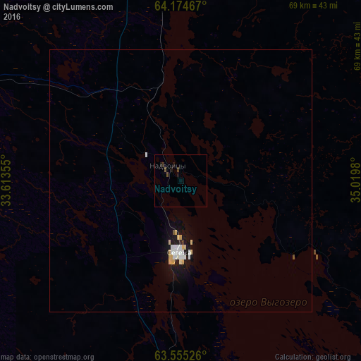
Analysis of Nadvoitsy night lights 2016
Square area 10x10 km:
 0%
0%90-99
0%80-89
0%70-79
0%60-69
0%50-59
0.38%40-49
0.67%30-39
0.38%20-29
0.1%10-19
1.52%0-9
96.95%Square area 50x50 km:
0.15%90-99
0.16%80-89
0.16%70-79
0.08%60-69
0%50-59
0.04%40-49
0.03%30-39
0.02%20-29
0.03%10-19
0.95%0-9
98.39%Clear (daylight) street map image can be seen on geolist.org.
Map coordinates:
64° 10' 28.8" North, 33° 36' 48.8" East
63° 52' 0" North, 34° 19' 0" East
63° 33' 18.9" North, 35° 1' 11.3" East
Some cities around Nadvoitsy sort by population:
• Kondopoga
184.7 km =114.8 mi,  180°
180°
• Segezha
13.9 km =8.6 mi, 178°
• Kostomuksha
197.1 km =122.5 mi,  293°
293°
• Onega
185.7 km =115.4 mi,  88°
88°
• Medvezh’yegorsk
105.8 km =65.7 mi, 176°
• Kem’
121.7 km =75.6 mi,  5°
5°
• Belomorsk
76.2 km =47.3 mi,  16°
16°
• Pindushi
106.6 km =66.2 mi,  172°
172°
523662 (p: 10,780)
Sources (retrieved 2019-11-25):
» Earth at Night: Flat Maps 2012, 2016