Buzuluk night lights from space
Night Light of Buzuluk (Orenburg Oblast) from space (Russia) Src. Average luminocity for 10x10km area is 28.899% and for 50x50km: 1.493%.
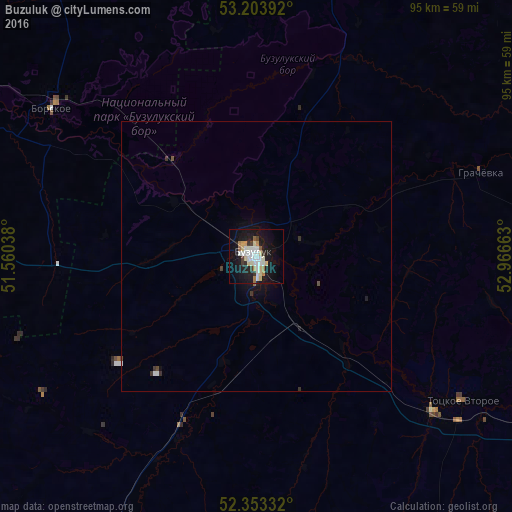

Analysis of Buzuluk night lights 2016
Square area 10x10 km:
 5.3%
5.3%90-99
8.08%80-89
4.04%70-79
2.27%60-69
2.78%50-59
1.01%40-49
1.14%30-39
2.4%20-29
3.03%10-19
32.83%0-9
37.12%Square area 50x50 km:
0.25%90-99
0.35%80-89
0.17%70-79
0.09%60-69
0.12%50-59
0.06%40-49
0.11%30-39
0.23%20-29
0.16%10-19
1.61%0-9
96.84%Clear (daylight) street map image can be seen on geolist.org.
Map coordinates:
53° 12' 14.1" North, 51° 33' 37.4" East
52° 46' 50.5" North, 52° 15' 48.6" East
52° 21' 12" North, 52° 57' 59.9" East
Some cities around Buzuluk sort by population:
• Otradnyy
90.2 km =56 mi,  317°
317°
• Sorochinsk
71.7 km =44.6 mi,  122°
122°
• Neftegorsk
73.8 km =45.9 mi,  271°
271°
• Kinel’-Cherkassy
93 km =57.8 mi,  325°
325°
• Borskoye
46.2 km =28.7 mi,  307°
307°
• Totskoye
44.1 km =27.4 mi,  130°
130°
• Bogatoye
69.7 km =43.3 mi,  296°
296°
• Krotovka
92.3 km =57.4 mi, 307°
570427 (p: 87,714)
Sources (retrieved 2019-11-25):
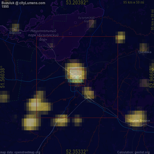
» NASA, Earths city lights 1995
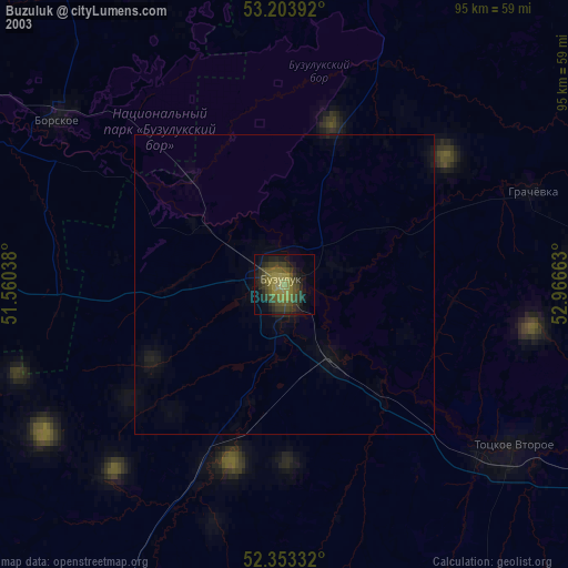
» NASA city lights 2003
» Earth at Night: Flat Maps 2012, 2016