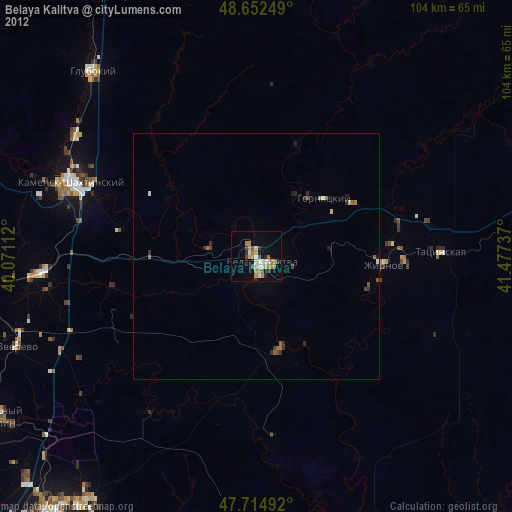
Belaya Kalitva night lights from space
Night Light of Belaya Kalitva (Rostov) from space (Russia) Src. Average luminocity for 10x10km area is 24.6146% and for 50x50km: 1.456%.

Analysis of Belaya Kalitva night lights 2016
Square area 10x10 km:
 2.68%
2.68%90-99
4.61%80-89
3.42%70-79
2.53%60-69
3.72%50-59
2.23%40-49
4.61%30-39
1.93%20-29
3.72%10-19
23.96%0-9
46.58%Square area 50x50 km:
0.13%90-99
0.2%80-89
0.19%70-79
0.12%60-69
0.24%50-59
0.16%40-49
0.34%30-39
0.2%20-29
0.22%10-19
1.15%0-9
97.06%Clear (daylight) street map image can be seen on geolist.org.
Map coordinates:
48° 39' 9" North, 40° 4' 16" East
48° 11' 9.1" North, 40° 46' 27.3" East
47° 42' 53.7" North, 41° 28' 38.5" East
Some cities around Belaya Kalitva sort by population:
• Kamensk-Shakhtinskiy
40.8 km =25.4 mi,  291°
291°
• Tatsinskiy
37.2 km =23.1 mi,  88°
88°
• Sholokhovskiy
22.7 km =14.1 mi,  62°
62°
• Gornyatskiy
16.6 km =10.3 mi,  42°
42°
• Koksovyy
9.8 km =6.1 mi,  277°
277°
• Staraya Stanitsa
39.8 km =24.7 mi,  296°
296°
• Sinegorskiy
19.8 km =12.3 mi,  164°
164°
• Zhirnov
26.1 km =16.2 mi, 93°
578155 (p: 47,521)
Sources (retrieved 2019-11-25):
» Earth at Night: Flat Maps 2012, 2016