Koksovyy night lights from space
Night Light of Koksovyy (Rostov) from space (Russia) Src. Average luminocity for 10x10km area is 0.9137% and for 50x50km: 1.8279%.
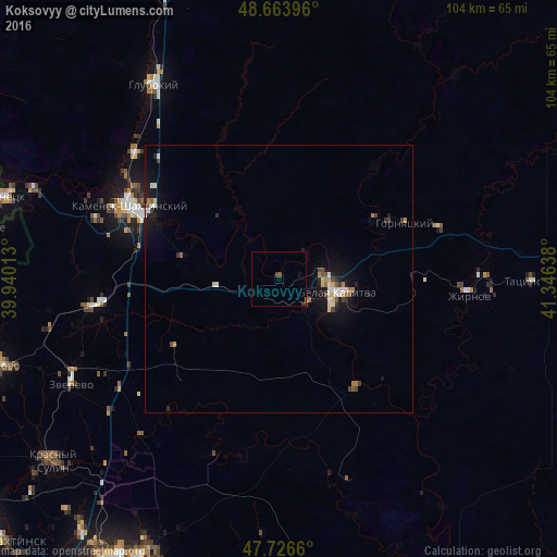
Analysis of Koksovyy night lights 2016
Square area 10x10 km:
 0%
0%90-99
0%80-89
0%70-79
0%60-69
0%50-59
0%40-49
1.19%30-39
0%20-29
0.3%10-19
0%0-9
98.51%Square area 50x50 km:
0.21%90-99
0.26%80-89
0.19%70-79
0.13%60-69
0.25%50-59
0.17%40-49
0.32%30-39
0.25%20-29
0.35%10-19
1.69%0-9
96.18%Clear (daylight) street map image can be seen on geolist.org.
Map coordinates:
48° 39' 50.3" North, 39° 56' 24.5" East
48° 11' 50.7" North, 40° 38' 35.7" East
47° 43' 35.8" North, 41° 20' 47" East
Some cities around Koksovyy sort by population:
• Kamensk-Shakhtinskiy
31.4 km =19.5 mi,  295°
295°
• Belaya Kalitva
9.8 km =6.1 mi,  97°
97°
• Likhovskoy
34.8 km =21.6 mi,  261°
261°
• Sholokhovskiy
31.2 km =19.4 mi,  72°
72°
• Gornyatskiy
23.5 km =14.6 mi,  62°
62°
• Staraya Stanitsa
30.7 km =19.1 mi, 302°
• Sinegorskiy
25.3 km =15.7 mi,  143°
143°
• Zhirnov
35.9 km =22.3 mi,  94°
94°
546579 (p: 8,458)
Sources (retrieved 2019-11-25):
» Earth at Night: Flat Maps 2012, 2016