Sinegorskiy night lights from space
Night Light of Sinegorskiy (Rostov) from space (Russia) Src. Average luminocity for 10x10km area is 1.9134% and for 50x50km: 1.4279%.
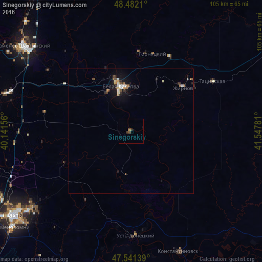
Analysis of Sinegorskiy night lights 2016
Square area 10x10 km:
 0%
0%90-99
0%80-89
0%70-79
0%60-69
1.14%50-59
0.57%40-49
0.99%30-39
0.71%20-29
0%10-19
0.57%0-9
96.02%Square area 50x50 km:
0.13%90-99
0.22%80-89
0.17%70-79
0.1%60-69
0.26%50-59
0.17%40-49
0.31%30-39
0.11%20-29
0.26%10-19
1.15%0-9
97.14%Clear (daylight) street map image can be seen on geolist.org.
Map coordinates:
48° 28' 55.6" North, 40° 8' 29.6" East
48° 0' 50" North, 40° 50' 40.8" East
47° 32' 29" North, 41° 32' 52.1" East
Some cities around Sinegorskiy sort by population:
• Belaya Kalitva
19.8 km =12.3 mi,  344°
344°
• Konstantinovsk
51.4 km =31.9 mi,  158°
158°
• Ust’-Donetskiy
41.4 km =25.7 mi,  177°
177°
• Tatsinskiy
37.9 km =23.5 mi,  57°
57°
• Sholokhovskiy
33.2 km =20.6 mi,  26°
26°
• Gornyatskiy
32 km =19.9 mi,  10°
10°
• Koksovyy
25.3 km =15.7 mi,  323°
323°
• Zhirnov
27.2 km =16.9 mi,  50°
50°
492853 (p: 6,660)
Sources (retrieved 2019-11-25):
» Earth at Night: Flat Maps 2012, 2016