Sombor night lights from space
Night Light of Sombor (Vojvodina) from space (Serbia) Src. Average luminocity for 10x10km area is 25.9032% and for 50x50km: 3.0403%.
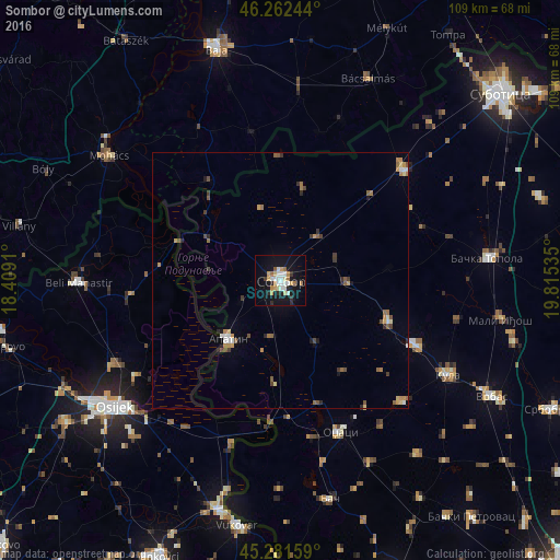
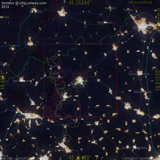
Analysis of Sombor night lights 2016
Square area 10x10 km:
 3.97%
3.97%90-99
5.71%80-89
2.54%70-79
3.97%60-69
4.13%50-59
1.11%40-49
0.16%30-39
1.59%20-29
4.44%10-19
30.48%0-9
41.9%Square area 50x50 km:
0.28%90-99
0.36%80-89
0.32%70-79
0.5%60-69
0.49%50-59
0.5%40-49
0.35%30-39
0.41%20-29
0.43%10-19
1.43%0-9
94.93%Clear (daylight) street map image can be seen on geolist.org.
Map coordinates:
46° 15' 44.8" North, 18° 24' 32.8" East
45° 46' 27" North, 19° 6' 44" East
45° 16' 53.7" North, 19° 48' 55.3" East
Some cities around Sombor sort by population:
• Mohács, HU
40.8 km =25.4 mi,  306°
306°
• Apatin
15.4 km =9.6 mi,  222°
222°
• Bačka Topola
40.5 km =25.2 mi,  83°
83°
• Beli Manastir, HR
39.4 km =24.5 mi,  269°
269°
• Sonta
20 km =12.4 mi,  183°
183°
• Stanišić
18.8 km =11.7 mi,  13°
13°
• Darda, HR
35.9 km =22.3 mi,  243°
243°
• Prigrevica
11 km =6.8 mi,  189°
189°
3190342 (p: 48,454)
Sources (retrieved 2019-11-25):
» Earth at Night: Flat Maps 2012, 2016