Stanišić night lights from space
Night Light of Stanišić (Vojvodina) from space (Serbia) Src. Average luminocity for 10x10km area is 1.4896% and for 50x50km: 2.2805%.
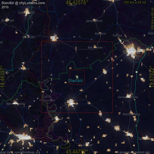
Analysis of Stanišić night lights 2016
Square area 10x10 km:
 0%
0%90-99
0%80-89
0%70-79
0%60-69
1.04%50-59
0.15%40-49
0.3%30-39
0.6%20-29
0.89%10-19
0%0-9
97.02%Square area 50x50 km:
0.17%90-99
0.26%80-89
0.19%70-79
0.38%60-69
0.42%50-59
0.31%40-49
0.24%30-39
0.35%20-29
0.51%10-19
1.48%0-9
95.71%Clear (daylight) street map image can be seen on geolist.org.
Map coordinates:
46° 25' 32.7" North, 18° 27' 50.3" East
45° 56' 20.2" North, 19° 10' 1.5" East
45° 26' 52.2" North, 19° 52' 12.8" East
Some cities around Stanišić sort by population:
• Sombor
18.8 km =11.7 mi,  193°
193°
• Baja, HU
31.8 km =19.8 mi,  328°
328°
• Mohács, HU
37.6 km =23.4 mi,  278°
278°
• Apatin
33 km =20.5 mi,  206°
206°
• Bačka Topola
38.5 km =23.9 mi,  110°
110°
• Bácsalmás, HU
24.5 km =15.2 mi,  31°
31°
• Mélykút, HU
34.9 km =21.7 mi, 28°
• Prigrevica
29.8 km =18.5 mi, 191°
3190042 (p: 5,476)
Sources (retrieved 2019-11-25):
» Earth at Night: Flat Maps 2012, 2016