Beli Manastir night lights from space
Night Light of Beli Manastir (Osječko-Baranjska) from space (Croatia) Src. Average luminocity for 10x10km area is 8.3032% and for 50x50km: 3.2304%.
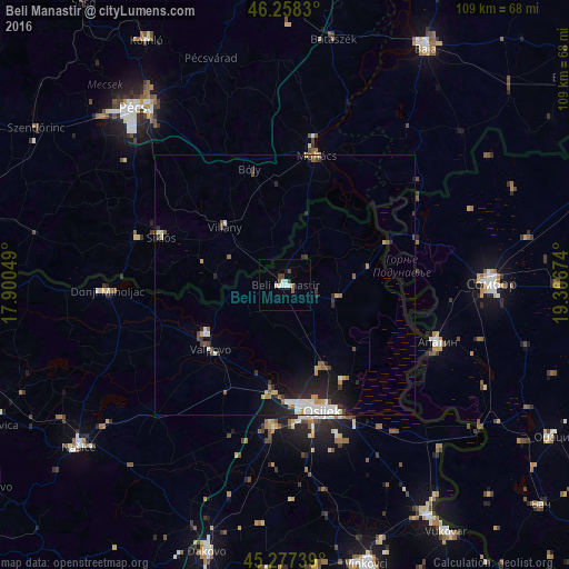
Analysis of Beli Manastir night lights 2016
Square area 10x10 km:
 2.22%
2.22%90-99
1.59%80-89
0.63%70-79
0%60-69
0.63%50-59
0.63%40-49
1.59%30-39
1.59%20-29
0%10-19
0.63%0-9
90.48%Square area 50x50 km:
0.56%90-99
0.67%80-89
0.16%70-79
0.36%60-69
0.22%50-59
0.37%40-49
0.46%30-39
0.41%20-29
1.06%10-19
2.07%0-9
93.66%Clear (daylight) street map image can be seen on geolist.org.
Map coordinates:
46° 15' 29.9" North, 17° 54' 1.8" East
45° 46' 12" North, 18° 36' 13" East
45° 16' 38.6" North, 19° 18' 24.3" East
Some cities around Beli Manastir sort by population:
• Osijek
25.3 km =15.7 mi,  163°
163°
• Mohács, HU
25.3 km =15.7 mi,  14°
14°
• Siklós, HU
25.5 km =15.8 mi,  291°
291°
• Čepin
27.6 km =17.1 mi,  186°
186°
• Valpovo
18.8 km =11.7 mi,  229°
229°
• Belišće
18.3 km =11.4 mi,  236°
236°
• Višnjevac
22.4 km =13.9 mi,  177°
177°
• Darda
17.5 km =10.9 mi,  154°
154°
3204320 (p: 8,713)
Sources (retrieved 2019-11-25):
» Earth at Night: Flat Maps 2012, 2016