Sonta night lights from space
Night Light of Sonta (Vojvodina) from space (Serbia) Src. Average luminocity for 10x10km area is 1.3439% and for 50x50km: 4.2178%.
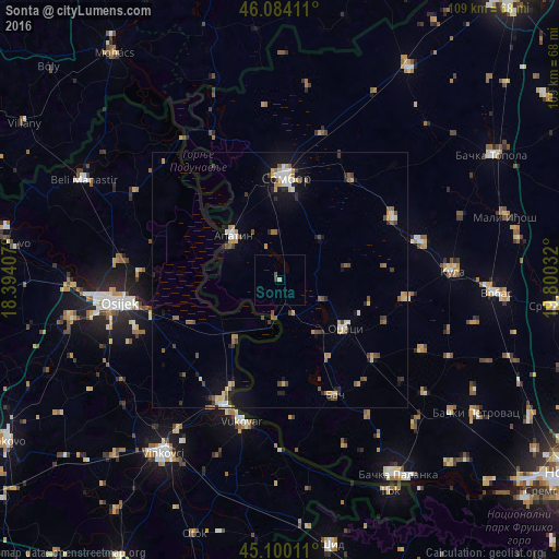
Analysis of Sonta night lights 2016
Square area 10x10 km:
 0%
0%90-99
0%80-89
0.61%70-79
0%60-69
0%50-59
0.45%40-49
0.45%30-39
0.3%20-29
0%10-19
0%0-9
98.18%Square area 50x50 km:
0.34%90-99
0.45%80-89
0.56%70-79
0.57%60-69
0.51%50-59
0.75%40-49
0.69%30-39
0.57%20-29
0.55%10-19
2.36%0-9
92.64%Clear (daylight) street map image can be seen on geolist.org.
Map coordinates:
46° 5' 2.8" North, 18° 23' 38.7" East
45° 35' 39.4" North, 19° 5' 49.9" East
45° 6' 0.4" North, 19° 48' 1.2" East
Some cities around Sonta sort by population:
• Osijek, HR
31.8 km =19.8 mi,  261°
261°
• Sombor
20 km =12.4 mi,  3°
3°
• Vukovar, HR
28 km =17.4 mi,  195°
195°
• Apatin
12.7 km =7.9 mi,  313°
313°
• Tenja, HR
29.3 km =18.2 mi,  248°
248°
• Darda, HR
31.1 km =19.3 mi,  276°
276°
• Borovo, HR
26.3 km =16.3 mi, 202°
• Prigrevica
9.2 km =5.7 mi,  355°
355°
3190335 (p: 5,991)
Sources (retrieved 2019-11-25):
» Earth at Night: Flat Maps 2012, 2016