Niš night lights from space
Night Light of Niš (Central Serbia) from space (Serbia) Src. Average luminocity for 10x10km area is 56.4439% and for 50x50km: 5.4646%.
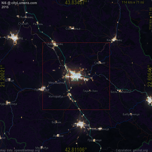
Analysis of Niš night lights 2016
Square area 10x10 km:
 17.42%
90-99
15.45%80-89
1.52%70-79
4.7%60-69
6.06%50-59
2.27%40-49
7.73%30-39
7.42%20-29
25.91%10-19
11.52%0-9
0%Square area 50x50 km:
0.94%90-99
0.87%80-89
0.26%70-79
0.46%60-69
0.44%50-59
0.81%40-49
0.99%30-39
1%20-29
2.11%10-19
3.54%0-9
88.58%Clear (daylight) street map image can be seen on geolist.org.
Map coordinates:
43° 50' 2.7" North, 21° 12' 0.8" East
43° 19' 29" North, 21° 54' 12" East
42° 48' 39.8" North, 22° 36' 23.3" East
Some cities around Niš sort by population:
• Leskovac
36.5 km =22.7 mi,  174°
174°
• Kruševac
54 km =33.6 mi,  301°
301°
• Zaječar
70.6 km =43.9 mi,  24°
24°
• Pirot
58.5 km =36.4 mi,  109°
109°
• Prokuplje
27.4 km =17 mi,  248°
248°
• Knjazevac
39.2 km =24.4 mi,  46°
46°
• Paraćin
71.7 km =44.6 mi,  326°
326°
• Belogradchik, BG
71.4 km =44.4 mi,  61°
61°
787657 (p: 250,000)
Sources (retrieved 2019-11-25):
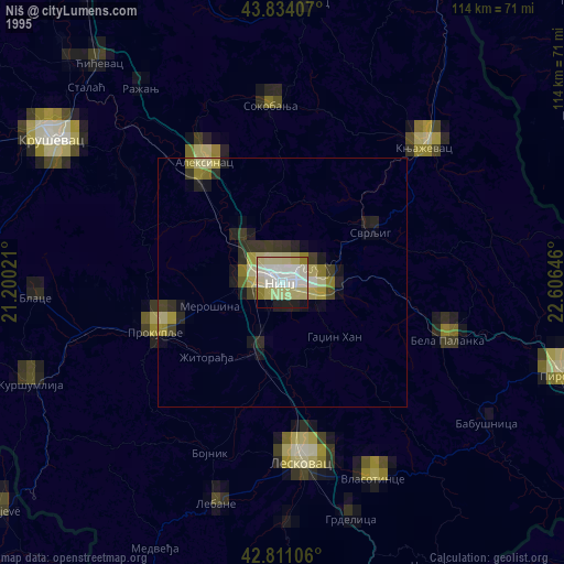
» NASA, Earths city lights 1995
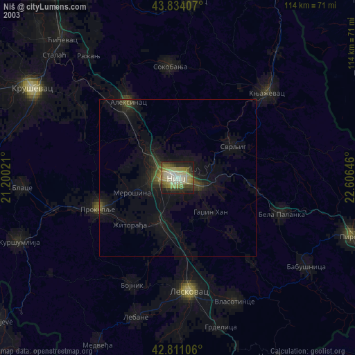
» NASA city lights 2003
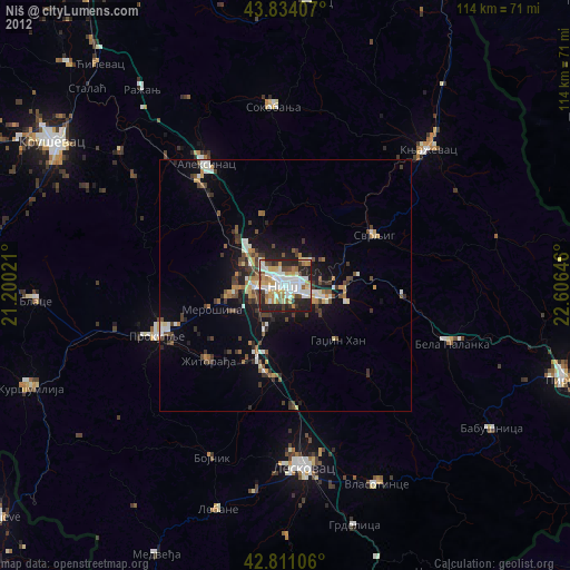
» Earth at Night: Flat Maps 2012, 2016