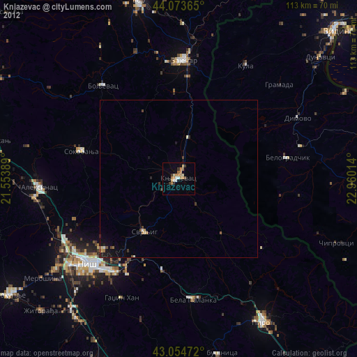
Knjazevac night lights from space
Night Light of Knjazevac (Central Serbia) from space (Serbia) Src. Average luminocity for 10x10km area is 10.6286% and for 50x50km: 0.74%.
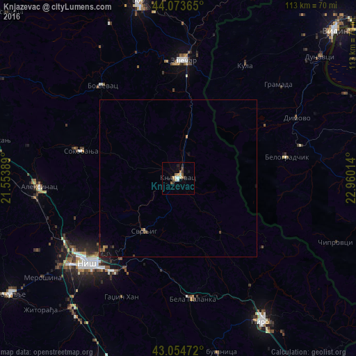
Analysis of Knjazevac night lights 2016
Square area 10x10 km:
 1.27%
1.27%90-99
1.27%80-89
2.22%70-79
0.32%60-69
1.59%50-59
1.59%40-49
1.27%30-39
1.27%20-29
2.54%10-19
1.27%0-9
85.4%Square area 50x50 km:
0.05%90-99
0.05%80-89
0.11%70-79
0.04%60-69
0.15%50-59
0.07%40-49
0.17%30-39
0.12%20-29
0.22%10-19
0.4%0-9
98.62%Clear (daylight) street map image can be seen on geolist.org.
Map coordinates:
44° 4' 25.1" North, 21° 33' 14" East
43° 33' 58.8" North, 22° 15' 25.2" East
43° 3' 17" North, 22° 57' 36.5" East
Some cities around Knjazevac sort by population:
• Niš
39.2 km =24.4 mi,  226°
226°
• Leskovac
68 km =42.3 mi,  201°
201°
• Zaječar
37.5 km =23.3 mi,  0°
0°
• Pirot
53.1 km =33 mi,  149°
149°
• Bor
58 km =36 mi,  347°
347°
• Prokuplje
65.5 km =40.7 mi,  235°
235°
• Ciupercenii Noi, RO
67.4 km =41.9 mi,  55°
55°
• Belogradchik, BG
35 km =21.7 mi,  78°
78°
6619277 (p: 25,000)
Sources (retrieved 2019-11-25):
» Earth at Night: Flat Maps 2012, 2016