Melenci night lights from space
Night Light of Melenci (Vojvodina) from space (Serbia) Src. Average luminocity for 10x10km area is 6.3864% and for 50x50km: 5.3611%.
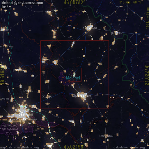
Analysis of Melenci night lights 2016
Square area 10x10 km:
 0.91%
0.91%90-99
1.52%80-89
0.61%70-79
0.15%60-69
0.76%50-59
0.3%40-49
1.06%30-39
0.15%20-29
1.06%10-19
1.36%0-9
92.12%Square area 50x50 km:
0.43%90-99
0.73%80-89
0.63%70-79
0.56%60-69
0.76%50-59
1.1%40-49
0.82%30-39
0.64%20-29
0.76%10-19
2.89%0-9
90.67%Clear (daylight) street map image can be seen on geolist.org.
Map coordinates:
46° 0' 26.4" North, 19° 36' 59.4" East
45° 31' 0.5" North, 20° 19' 10.6" East
45° 1' 19.1" North, 21° 1' 21.9" East
Some cities around Melenci sort by population:
• Zrenjanin
15.6 km =9.7 mi,  161°
161°
• Bečej
24.9 km =15.5 mi,  296°
296°
• Čurug
20.2 km =12.6 mi,  255°
255°
• Bačko Petrovo Selo
28.2 km =17.5 mi,  318°
318°
• Žabalj
25.6 km =15.9 mi,  231°
231°
• Novo Miloševo
22.5 km =14 mi,  356°
356°
• Bačko Gradište
22.6 km =14 mi,  274°
274°
• Ečka
23.6 km =14.7 mi, 155°
788040 (p: 7,685)
Sources (retrieved 2019-11-25):
» Earth at Night: Flat Maps 2012, 2016