Čurug night lights from space
Night Light of Čurug (Vojvodina) from space (Serbia) Src. Average luminocity for 10x10km area is 4.7651% and for 50x50km: 8.604%.
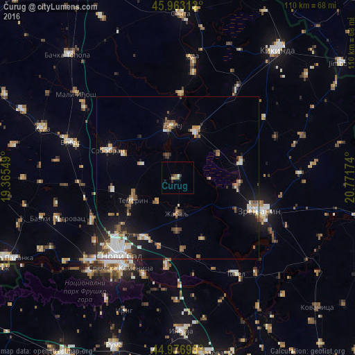
Analysis of Čurug night lights 2016
Square area 10x10 km:
 0.16%
0.16%90-99
0.48%80-89
0.95%70-79
0.32%60-69
0.16%50-59
2.22%40-49
0.16%30-39
1.11%20-29
1.11%10-19
0.32%0-9
93.02%Square area 50x50 km:
1.38%90-99
1.62%80-89
0.79%70-79
0.89%60-69
0.86%50-59
1.39%40-49
0.91%30-39
1.02%20-29
1.72%10-19
3.88%0-9
85.55%Clear (daylight) street map image can be seen on geolist.org.
Map coordinates:
45° 57' 47.2" North, 19° 21' 55.8" East
45° 28' 20" North, 20° 4' 7" East
44° 58' 37.1" North, 20° 46' 18.3" East
Some cities around Čurug sort by population:
• Zrenjanin
26.4 km =16.4 mi,  111°
111°
• Bečej
16.3 km =10.1 mi,  350°
350°
• Petrovaradin
29.1 km =18.1 mi,  210°
210°
• Bačko Petrovo Selo
26.1 km =16.2 mi,  1°
1°
• Žabalj
11.1 km =6.9 mi,  181°
181°
• Melenci
20.2 km =12.6 mi,  75°
75°
• Bačko Gradište
7.3 km =4.5 mi,  336°
336°
• Kovilj
26.7 km =16.6 mi,  187°
187°
791672 (p: 9,231)
Sources (retrieved 2019-11-25):
» Earth at Night: Flat Maps 2012, 2016