Zrenjanin night lights from space
Night Light of Zrenjanin (Vojvodina) from space (Serbia) Src. Average luminocity for 10x10km area is 39.1921% and for 50x50km: 5.0381%.
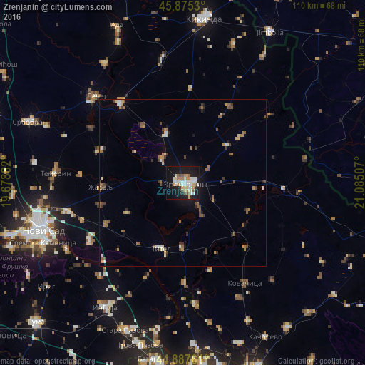
Analysis of Zrenjanin night lights 2016
Square area 10x10 km:
 7.14%
7.14%90-99
11.11%80-89
5.24%70-79
2.86%60-69
4.92%50-59
3.49%40-49
2.7%30-39
0.63%20-29
5.87%10-19
42.38%0-9
13.65%Square area 50x50 km:
0.46%90-99
0.76%80-89
0.51%70-79
0.49%60-69
0.71%50-59
1.09%40-49
0.73%30-39
0.64%20-29
0.58%10-19
2.95%0-9
91.08%Clear (daylight) street map image can be seen on geolist.org.
Map coordinates:
45° 52' 31.1" North, 19° 40' 43.8" East
45° 23' 1" North, 20° 22' 55" East
44° 53' 15.4" North, 21° 5' 6.3" East
Some cities around Zrenjanin sort by population:
• Čurug
26.4 km =16.4 mi,  291°
291°
• Žabalj
24.9 km =15.5 mi,  267°
267°
• Melenci
15.6 km =9.7 mi,  341°
341°
• Kovačica
35.6 km =22.1 mi,  148°
148°
• Titel
20.9 km =13 mi,  199°
199°
• Bačko Gradište
32 km =19.9 mi,  301°
301°
• Ečka
8.2 km =5.1 mi,  144°
144°
• Kovilj
32.6 km =20.3 mi,  239°
239°
783814 (p: 79,773)
Sources (retrieved 2019-11-25):
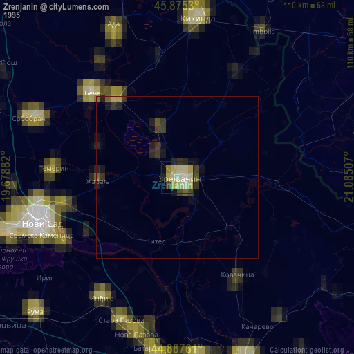
» NASA, Earths city lights 1995
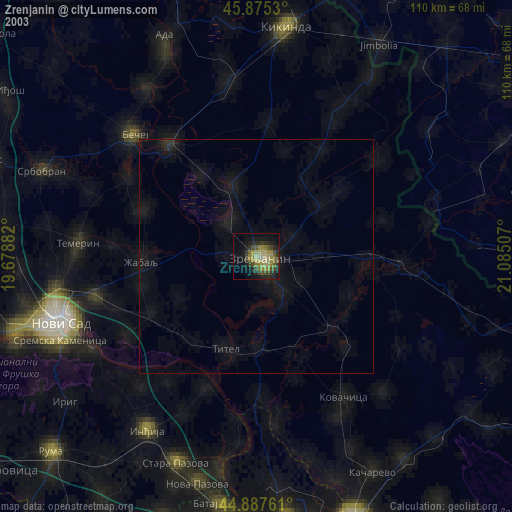
» NASA city lights 2003
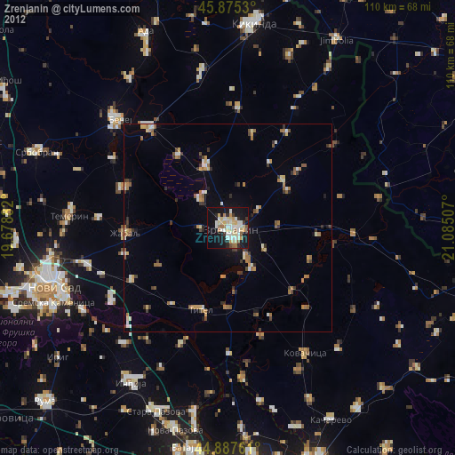
» Earth at Night: Flat Maps 2012, 2016