Paraguarí night lights from space
Night Light of Paraguarí from space (Paraguay) Src. Average luminocity for 10x10km area is 20.2216% and for 50x50km: 9.359%.
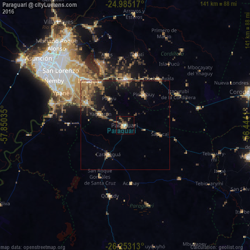
Analysis of Paraguarí night lights 2016
Square area 10x10 km:
 1.14%
1.14%90-99
1.14%80-89
2.46%70-79
2.27%60-69
6.25%50-59
1.89%40-49
5.3%30-39
6.06%20-29
0%10-19
12.5%0-9
60.98%Square area 50x50 km:
0.25%90-99
0.4%80-89
1.25%70-79
1.36%60-69
2.92%50-59
1.47%40-49
2.01%30-39
2.03%20-29
1.96%10-19
6.13%0-9
80.22%Clear (daylight) street map image can be seen on geolist.org.
Map coordinates:
24° 59' 6.6" South, 57° 51' 1.3" West
25° 37' 15" South, 57° 8' 50" West
26° 15' 11.3" South, 56° 26' 38.8" West
Some cities around Paraguarí sort by population:
• Itauguá
32.8 km =20.4 mi,  320°
320°
• Caacupé
26.1 km =16.2 mi,  1°
1°
• Itá
25.8 km =16 mi,  301°
301°
• Piribebuy
20.3 km =12.6 mi,  31°
31°
• Ypacarai
27.6 km =17.1 mi,  329°
329°
• Eusebio Ayala
32.4 km =20.1 mi,  35°
35°
• Yaguarón
15.2 km =9.4 mi, 295°
• Carapeguá
21.7 km =13.5 mi,  203°
203°
3437600 (p: 10,079)
Sources (retrieved 2019-11-25):
» Earth at Night: Flat Maps 2012, 2016