Oiã night lights from space
Night Light of Oiã (Aveiro) from space (Portugal) Src. Average luminocity for 10x10km area is 45.3393% and for 50x50km: 24.5105%.
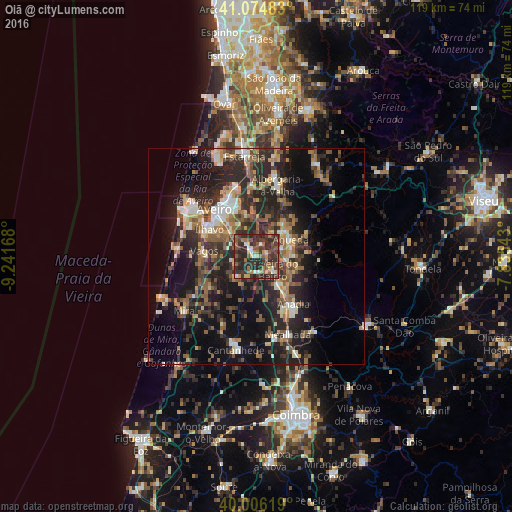
Analysis of Oiã night lights 2016
Square area 10x10 km:
100  2.11%
2.11%
90-99 5.52%
80-89 3.9%
70-79 5.36%
60-69 7.95%
50-59 11.04%
40-49 9.25%
30-39 21.27%
20-29 33.44%
10-19 0.16%
0-9 0%
2.11%90-99
5.52%80-89
3.9%70-79
5.36%60-69
7.95%50-59
11.04%40-49
9.25%30-39
21.27%20-29
33.44%10-19
0.16%0-9
0%Square area 50x50 km:
100 1.83%
90-99 3.38%
80-89 2.48%
70-79 2.65%
60-69 4.11%
50-59 4.92%
40-49 3.53%
30-39 5.89%
20-29 12.32%
10-19 16.79%
0-9 42.1%
1.83%90-99
3.38%80-89
2.48%70-79
2.65%60-69
4.11%50-59
4.92%40-49
3.53%30-39
5.89%20-29
12.32%10-19
16.79%0-9
42.1%Clear (daylight) street map image can be seen on geolist.org.
Map coordinates:
41° 4' 29.4" North, 9° 14' 30" West
40° 32' 33.5" North, 8° 32' 18.8" West
40° 0' 22.3" North, 7° 50' 7.5" West
Some cities around Oiã sort by population:
• Ílhavo
12.9 km =8 mi,  300°
300°
• Esgueira
14.1 km =8.8 mi,  327°
327°
• Águeda
8.8 km =5.5 mi,  64°
64°
• Aradas
12.3 km =7.6 mi,  314°
314°
• Arcos
13.4 km =8.3 mi,  142°
142°
• Oliveira do Bairro
4.9 km =3 mi,  129°
129°
• Eixo
9.8 km =6.1 mi,  344°
344°
• Valongo
11.1 km =6.9 mi,  42°
42°
2737088 (p: 7,118)
Sources (retrieved 2019-11-25):
» Earth at Night: Flat Maps 2012, 2016