Eixo night lights from space
Night Light of Eixo (Aveiro) from space (Portugal) Src. Average luminocity for 10x10km area is 51.3994% and for 50x50km: 26.584%.
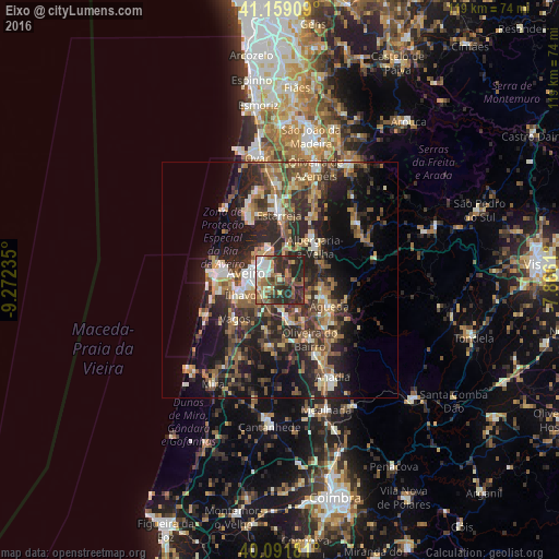
Analysis of Eixo night lights 2016
Square area 10x10 km:
100  7.79%
7.79%
90-99 6.98%
80-89 6.17%
70-79 5.52%
60-69 9.25%
50-59 11.36%
40-49 6.49%
30-39 14.77%
20-29 30.68%
10-19 0.97%
0-9 0%
7.79%90-99
6.98%80-89
6.17%70-79
5.52%60-69
9.25%50-59
11.36%40-49
6.49%30-39
14.77%20-29
30.68%10-19
0.97%0-9
0%Square area 50x50 km:
100 1.8%
90-99 3.73%
80-89 2.84%
70-79 3.14%
60-69 4.85%
50-59 5.65%
40-49 4.24%
30-39 6.73%
20-29 12.88%
10-19 15.04%
0-9 39.09%
1.8%90-99
3.73%80-89
2.84%70-79
3.14%60-69
4.85%50-59
5.65%40-49
4.24%30-39
6.73%20-29
12.88%10-19
15.04%0-9
39.09%Clear (daylight) street map image can be seen on geolist.org.
Map coordinates:
41° 9' 32.7" North, 9° 16' 20.5" West
40° 37' 39.3" North, 8° 34' 9.2" West
40° 5' 30.5" North, 7° 51' 58" West
Some cities around Eixo sort by population:
• Aveiro
6.7 km =4.2 mi,  286°
286°
• Ílhavo
9 km =5.6 mi,  251°
251°
• Esgueira
5.6 km =3.5 mi,  295°
295°
• Águeda
11.9 km =7.4 mi,  117°
117°
• Albergaria-a-Velha
10.5 km =6.5 mi,  45°
45°
• Aradas
6.2 km =3.9 mi,  263°
263°
• Oiã
9.8 km =6.1 mi,  164°
164°
• Valongo
10.1 km =6.3 mi,  96°
96°
2740031 (p: 5,978)
Sources (retrieved 2019-11-25):
» Earth at Night: Flat Maps 2012, 2016