Maceira night lights from space
Night Light of Maceira (Leiria) from space (Portugal) Src. Average luminocity for 10x10km area is 44.0341% and for 50x50km: 23.1903%.
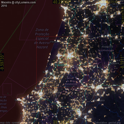
Analysis of Maceira night lights 2016
Square area 10x10 km:
 2.27%
2.27%90-99
5.03%80-89
3.08%70-79
6.01%60-69
8.77%50-59
12.99%40-49
12.34%30-39
14.12%20-29
19.97%10-19
15.42%0-9
0%Square area 50x50 km:
1.47%90-99
2.62%80-89
1.81%70-79
2.57%60-69
3.76%50-59
4.99%40-49
4.35%30-39
5.15%20-29
10.01%10-19
24.48%0-9
38.8%Clear (daylight) street map image can be seen on geolist.org.
Map coordinates:
40° 13' 38.9" North, 9° 35' 50.5" West
39° 41' 18.7" North, 8° 53' 39.2" West
39° 8' 43.2" North, 8° 11' 28" West
Some cities around Maceira sort by population:
• Leiria
9.6 km =6 mi,  50°
50°
• Marinha Grande
7.3 km =4.5 mi,  333°
333°
• Alcobaça
16.7 km =10.4 mi,  205°
205°
• Batalha
6.7 km =4.2 mi,  117°
117°
• Aljubarrota
13.8 km =8.6 mi,  192°
192°
• Porto de Mós
11.6 km =7.2 mi,  146°
146°
• Pataias
8.9 km =5.5 mi,  256°
256°
• Caranguejeira
17.2 km =10.7 mi,  68°
68°
2266914 (p: 9,831)
Sources (retrieved 2019-11-25):
» Earth at Night: Flat Maps 2012, 2016