Pataias night lights from space
Night Light of Pataias (Leiria) from space (Portugal) Src. Average luminocity for 10x10km area is 22.3636% and for 50x50km: 19.2403%.
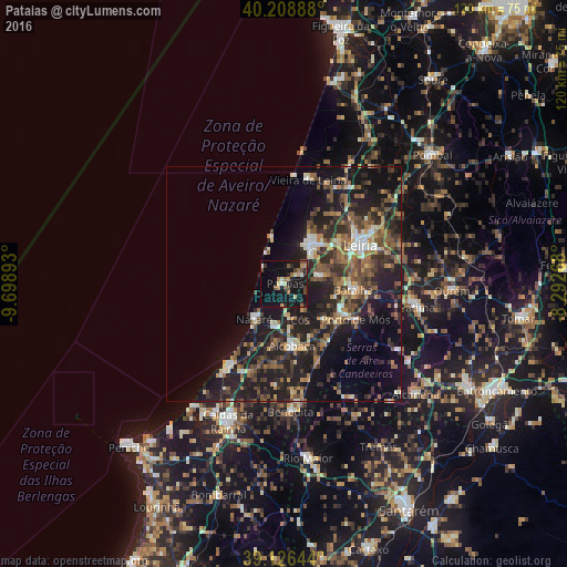
Analysis of Pataias night lights 2016
Square area 10x10 km:
 0.65%
0.65%90-99
1.95%80-89
2.6%70-79
2.76%60-69
4.06%50-59
3.57%40-49
4.38%30-39
1.79%20-29
3.9%10-19
44.97%0-9
29.38%Square area 50x50 km:
1.34%90-99
2.41%80-89
1.46%70-79
2.04%60-69
3.12%50-59
4.07%40-49
3.62%30-39
4.37%20-29
8.47%10-19
18.02%0-9
51.09%Clear (daylight) street map image can be seen on geolist.org.
Map coordinates:
40° 12' 32" North, 9° 41' 56.1" West
39° 40' 11.2" North, 8° 59' 44.9" West
39° 7' 35.2" North, 8° 17' 33.6" West
Some cities around Pataias sort by population:
• Leiria
18.1 km =11.2 mi,  63°
63°
• Marinha Grande
10.2 km =6.3 mi,  32°
32°
• Alcobaça
13.2 km =8.2 mi,  173°
173°
• Maceira
8.9 km =5.5 mi,  76°
76°
• Nazaré
9.7 km =6 mi,  219°
219°
• Batalha
14.7 km =9.1 mi,  94°
94°
• Aljubarrota
12.8 km =8 mi,  153°
153°
• Porto de Mós
17 km =10.6 mi,  116°
116°
2265120 (p: 5,510)
Sources (retrieved 2019-11-25):
» Earth at Night: Flat Maps 2012, 2016