Gafanha da Nazaré night lights from space
Night Light of Gafanha da Nazaré (Aveiro) from space (Portugal) Src. Average luminocity for 10x10km area is 56.0081% and for 50x50km: 24.3096%.
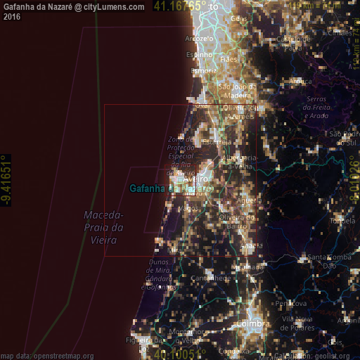
Analysis of Gafanha da Nazaré night lights 2016
Square area 10x10 km:
 10.55%
90-99
17.05%80-89
7.79%70-79
3.9%60-69
7.31%50-59
7.79%40-49
3.57%30-39
7.63%20-29
16.07%10-19
17.05%0-9
1.3%Square area 50x50 km:
1.81%90-99
3.57%80-89
2.69%70-79
3.02%60-69
4.65%50-59
5.35%40-49
3.75%30-39
6.31%20-29
11.6%10-19
11.26%0-9
46%Clear (daylight) street map image can be seen on geolist.org.
Map coordinates:
41° 10' 3.5" North, 9° 24' 59.4" West
40° 38' 10.4" North, 8° 42' 48.2" West
40° 6' 1.8" North, 8° 0' 36.9" West
Some cities around Gafanha da Nazaré sort by population:
• Aveiro
5.8 km =3.6 mi,  81°
81°
• Ílhavo
5.3 km =3.3 mi,  136°
136°
• Esgueira
7.2 km =4.5 mi, 78°
• Murtosa
12.9 km =8 mi,  29°
29°
• Beduido
19.2 km =11.9 mi,  42°
42°
• Aradas
6.3 km =3.9 mi,  105°
105°
• Oiã
18.1 km =11.2 mi,  125°
125°
• Eixo
12.2 km =7.6 mi,  94°
94°
2739152 (p: 14,840)
Sources (retrieved 2019-11-25):
» Earth at Night: Flat Maps 2012, 2016