Aveiro night lights from space
Night Light of Aveiro from space (Portugal) Src. Average luminocity for 10x10km area is 68.612% and for 50x50km: 26.7104%.
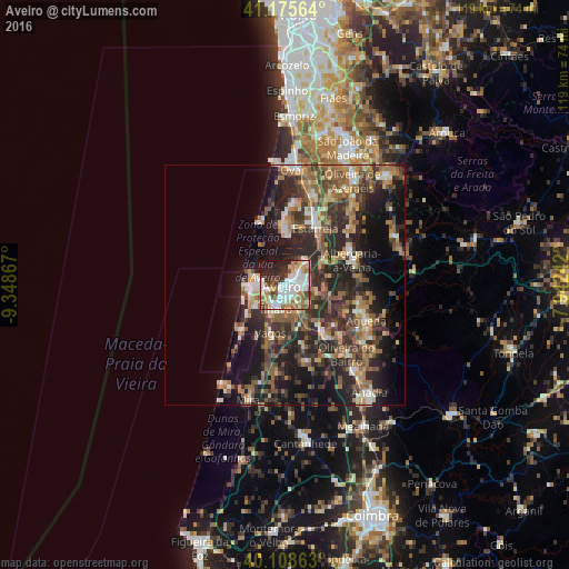
Analysis of Aveiro night lights 2016
Square area 10x10 km:
 20.13%
90-99
18.83%80-89
6.33%70-79
7.31%60-69
10.23%50-59
7.47%40-49
5.19%30-39
7.63%20-29
12.66%10-19
4.22%0-9
0%Square area 50x50 km:
1.94%90-99
3.85%80-89
2.9%70-79
3.39%60-69
5.28%50-59
5.66%40-49
4.06%30-39
6.7%20-29
12.03%10-19
13.97%0-9
40.21%Clear (daylight) street map image can be seen on geolist.org.
Map coordinates:
41° 10' 32.3" North, 9° 20' 55.2" West
40° 38' 39.4" North, 8° 38' 43.9" West
40° 6' 31.1" North, 7° 56' 32.7" West
Some cities around Aveiro sort by population:
• Ílhavo
5.2 km =3.2 mi,  203°
203°
• Gafanha da Nazaré
5.8 km =3.6 mi,  261°
261°
• Esgueira
1.5 km =0.9 mi,  68°
68°
• Murtosa
10.3 km =6.4 mi,  3°
3°
• Albergaria-a-Velha
15 km =9.3 mi, 68°
• Aradas
2.6 km =1.6 mi,  173°
173°
• Oiã
14.5 km =9 mi,  141°
141°
• Eixo
6.7 km =4.2 mi,  106°
106°
2742611 (p: 54,162)
Sources (retrieved 2019-11-25):
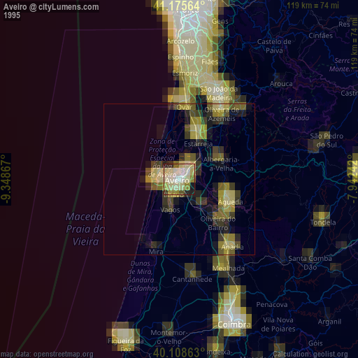
» NASA, Earths city lights 1995
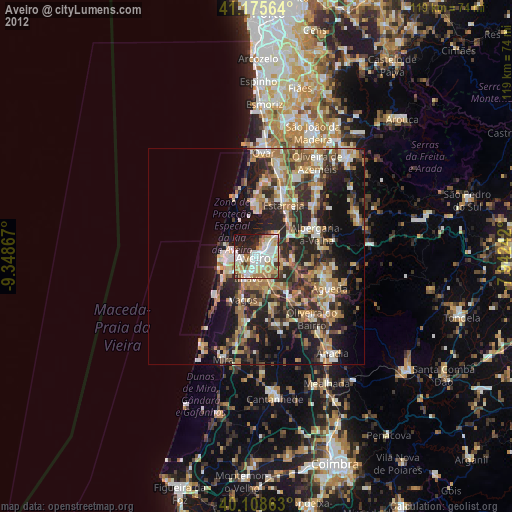
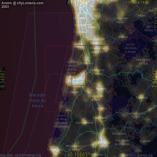
» NASA city lights 2003
» Earth at Night: Flat Maps 2012, 2016