Alvalade night lights from space
Night Light of Alvalade (Lisbon) from space (Portugal) Src. Average luminocity for 10x10km area is 94.9966% and for 50x50km: 53.973%.
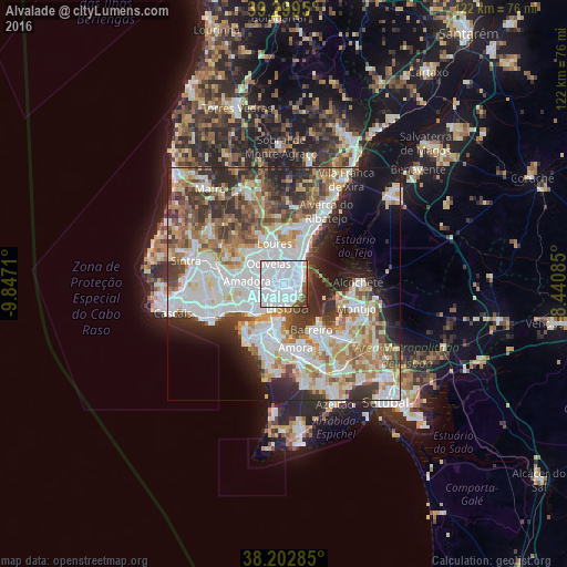
Analysis of Alvalade night lights 2016
Square area 10x10 km:
 80.61%
90-99
9.01%80-89
0.34%70-79
0%60-69
1.7%50-59
4.93%40-49
2.55%30-39
0.68%20-29
0.17%10-19
0%0-9
0%Square area 50x50 km:
15.94%90-99
13.25%80-89
5.24%70-79
5.53%60-69
7.44%50-59
6.18%40-49
5.84%30-39
6.97%20-29
8.67%10-19
7.23%0-9
17.72%Clear (daylight) street map image can be seen on geolist.org.
Map coordinates:
39° 17' 58.2" North, 9° 50' 49.6" West
38° 45' 11.8" North, 9° 8' 38.3" West
38° 12' 10.3" North, 8° 26' 27.1" West
Some cities around Alvalade sort by population:
• Lisbon
4.2 km =2.6 mi,  167°
167°
• Benfica
5.1 km =3.2 mi,  266°
266°
• Olivais
3.7 km =2.3 mi,  60°
60°
• Moscavide e Portela
4.6 km =2.9 mi,  51°
51°
• Beato António
4.2 km =2.6 mi,  122°
122°
• Charneca
3.4 km =2.1 mi,  0°
0°
• Prior Velho
4.7 km =2.9 mi,  24°
24°
• Olival do Basto
4.6 km =2.9 mi,  335°
335°
6930162 (p: 31,813)
Sources (retrieved 2019-11-25):
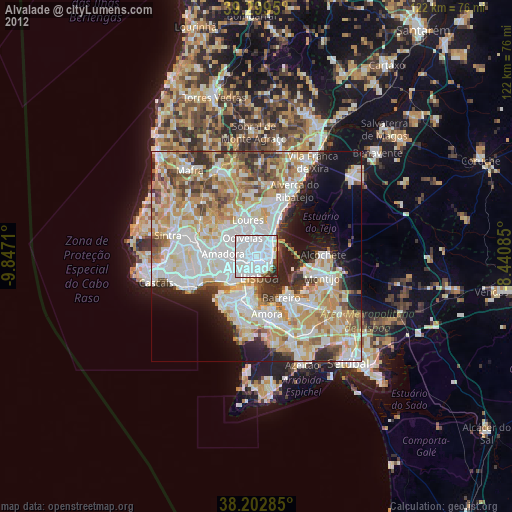
» Earth at Night: Flat Maps 2012, 2016