Benfica night lights from space
Night Light of Benfica (Lisbon) from space (Portugal) Src. Average luminocity for 10x10km area is 99.1293% and for 50x50km: 53.0552%.
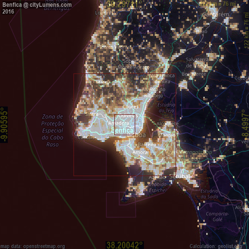
Analysis of Benfica night lights 2016
Square area 10x10 km:
100  84.52%
90-99 12.41%
80-89 2.38%
70-79 0.34%
60-69 0.34%
50-59 0%
40-49 0%
30-39 0%
20-29 0%
10-19 0%
0-9 0%
84.52%90-99
12.41%80-89
2.38%70-79
0.34%60-69
0.34%50-59
0%40-49
0%30-39
0%20-29
0%10-19
0%0-9
0%Square area 50x50 km:
100 15.66%
90-99 12.92%
80-89 5.23%
70-79 5.45%
60-69 7.19%
50-59 5.84%
40-49 5.74%
30-39 7.21%
20-29 8.99%
10-19 7.28%
0-9 18.5%
15.66%90-99
12.92%80-89
5.23%70-79
5.45%60-69
7.19%50-59
5.84%40-49
5.74%30-39
7.21%20-29
8.99%10-19
7.28%0-9
18.5%Clear (daylight) street map image can be seen on geolist.org.
Map coordinates:
39° 17' 49.6" North, 9° 54' 21.4" West
38° 45' 3.1" North, 9° 12' 10.2" West
38° 12' 1.5" North, 8° 29' 58.9" West
Some cities around Benfica sort by population:
• Amadora
2.5 km =1.6 mi,  277°
277°
• Queluz
4.5 km =2.8 mi, 278°
• Odivelas
4.9 km =3 mi,  19°
19°
• Alvalade
5.1 km =3.2 mi,  86°
86°
• Carnaxide
4.6 km =2.9 mi,  235°
235°
• Pontinha
1.9 km =1.2 mi,  9°
9°
• Alfragide
2.5 km =1.6 mi,  214°
214°
• Famões
4.2 km =2.6 mi,  351°
351°
2270962 (p: 36,985)
Sources (retrieved 2019-11-25):
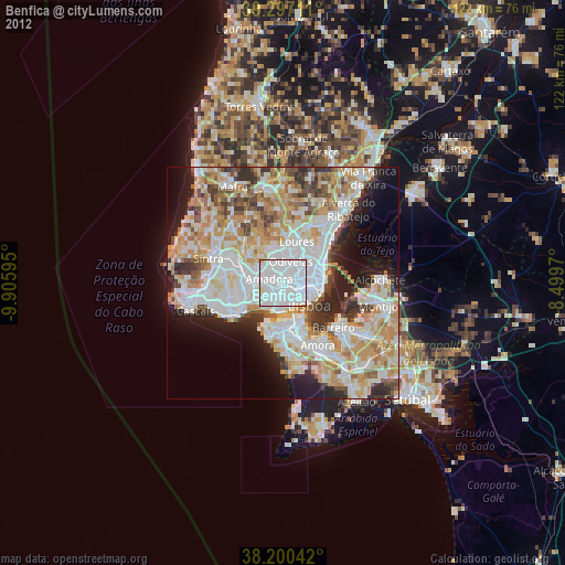
» Earth at Night: Flat Maps 2012, 2016