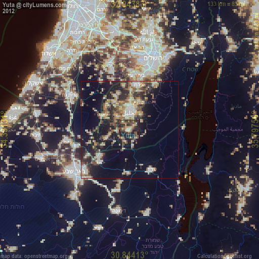
Yuta night lights from space
Night Light of Yuta (West Bank) from space (Palestinian Territory) Src. Average luminocity for 10x10km area is 53.0699% and for 50x50km: 27.0222%.
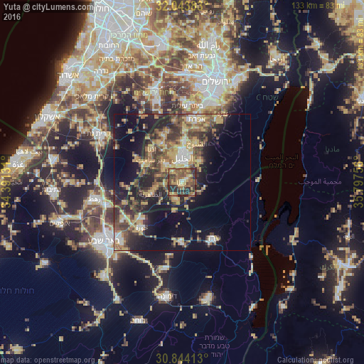
Analysis of Yuta night lights 2016
Square area 10x10 km:
 1.4%
1.4%90-99
1.75%80-89
6.64%70-79
18.18%60-69
9.09%50-59
17.48%40-49
14.51%30-39
10.84%20-29
19.76%10-19
0.35%0-9
0%Square area 50x50 km:
1.91%90-99
2.41%80-89
3.77%70-79
7.62%60-69
2.56%50-59
4.53%40-49
6.37%30-39
5.45%20-29
8.28%10-19
14.25%0-9
42.84%Clear (daylight) street map image can be seen on geolist.org.
Map coordinates:
32° 2' 37.8" North, 34° 23' 28.7" East
31° 26' 45.2" North, 35° 5' 39.9" East
30° 50' 38.9" North, 35° 47' 51.2" East
Some cities around Yuta sort by population:
• Hebron
9.3 km =5.8 mi,  359°
359°
• Az̧ Z̧āhirīyah
12.2 km =7.6 mi,  250°
250°
• Dūrā
9.2 km =5.7 mi,  318°
318°
• Banī Na‘īm
10.2 km =6.3 mi,  40°
40°
• As Samū‘
6.1 km =3.8 mi,  206°
206°
• Taffūḩ
11.1 km =6.9 mi,  337°
337°
• Dayr Sāmit
14.1 km =8.8 mi,  306°
306°
• Bayt Kāḩil
14.1 km =8.8 mi,  348°
348°
281292 (p: 41,425)
Sources (retrieved 2019-11-25):
» Earth at Night: Flat Maps 2012, 2016