Hebron night lights from space
Night Light of Hebron (West Bank) from space (Palestinian Territory) Src. Average luminocity for 10x10km area is 78.1224% and for 50x50km: 32.5108%.
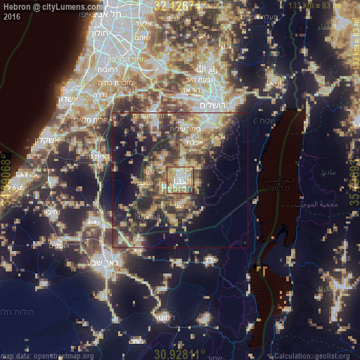
Analysis of Hebron night lights 2016
Square area 10x10 km:
 13.81%
90-99
19.76%80-89
12.76%70-79
26.4%60-69
7.52%50-59
13.46%40-49
1.92%30-39
4.02%20-29
0.35%10-19
0%0-9
0%Square area 50x50 km:
2.95%90-99
3.53%80-89
5.18%70-79
8.19%60-69
3.53%50-59
5.43%40-49
7.52%30-39
6.31%20-29
9.17%10-19
13.66%0-9
34.52%Clear (daylight) street map image can be seen on geolist.org.
Map coordinates:
32° 7' 36.3" North, 34° 23' 26.4" East
31° 31' 45.7" North, 35° 5' 37.7" East
30° 55' 41.2" North, 35° 47' 48.9" East
Some cities around Hebron sort by population:
• Yuta
9.3 km =5.8 mi,  179°
179°
• Ḩalḩūl
5.7 km =3.5 mi,  7°
7°
• Dūrā
6.6 km =4.1 mi,  248°
248°
• Banī Na‘īm
6.8 km =4.2 mi,  102°
102°
• Sa‘īr
7 km =4.3 mi,  38°
38°
• Taffūḩ
4.3 km =2.7 mi,  283°
283°
• Ash Shuyūkh
7.4 km =4.6 mi,  52°
52°
• Bayt Kāḩil
5.3 km =3.3 mi,  328°
328°
285066 (p: 160,470)
Sources (retrieved 2019-11-25):
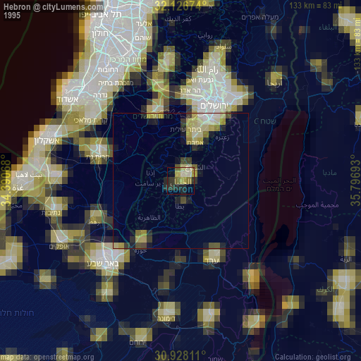
» NASA, Earths city lights 1995
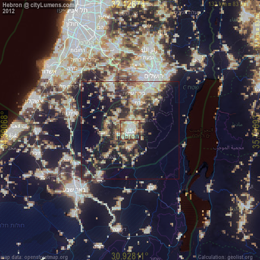
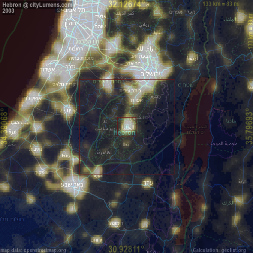
» NASA city lights 2003
» Earth at Night: Flat Maps 2012, 2016