Ramallah night lights from space
Night Light of Ramallah (West Bank) from space (Palestinian Territory) Src. Average luminocity for 10x10km area is 87.5238% and for 50x50km: 55.1428%.
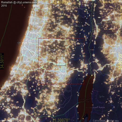
Analysis of Ramallah night lights 2016
Square area 10x10 km:
 25.09%
90-99
28.94%80-89
21.98%70-79
9.71%60-69
9.16%50-59
4.95%40-49
0.18%30-39
0%20-29
0%10-19
0%0-9
0%Square area 50x50 km:
9.53%90-99
9.75%80-89
10.8%70-79
10.56%60-69
6.54%50-59
8.6%40-49
10.35%30-39
7.22%20-29
6.93%10-19
6.82%0-9
12.91%Clear (daylight) street map image can be seen on geolist.org.
Map coordinates:
32° 29' 40.7" North, 34° 30' 4" East
31° 53' 58.7" North, 35° 12' 15.2" East
31° 18' 2.8" North, 35° 54' 26.5" East
Some cities around Ramallah sort by population:
• Al Bīrah
1.6 km =1 mi,  45°
45°
• Kalandia
3.8 km =2.4 mi,  162°
162°
• Ar Rām wa Ḑāḩiyat al Barīd
6.3 km =3.9 mi,  153°
153°
• Baytūnyā
3.2 km =2 mi,  263°
263°
• Givat Zeev
5.4 km =3.4 mi,  218°
218°
• Dayr Dibwān
6 km =3.7 mi,  77°
77°
• Bīr Zayt
7.8 km =4.8 mi,  352°
352°
• Az Zaytūnīyah
7.2 km =4.5 mi,  326°
326°
282239 (p: 24,599)
Sources (retrieved 2019-11-25):
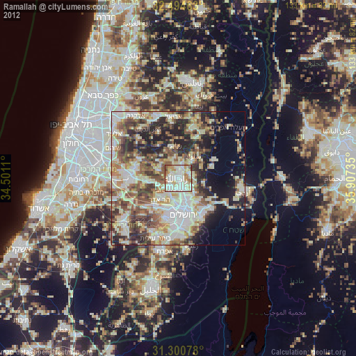
» Earth at Night: Flat Maps 2012, 2016