Baytūnyā night lights from space
Night Light of Baytūnyā (West Bank) from space (Palestinian Territory) Src. Average luminocity for 10x10km area is 82.2216% and for 50x50km: 57.8083%.
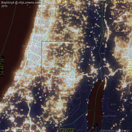
Analysis of Baytūnyā night lights 2016
Square area 10x10 km:
 21.79%
90-99
24.91%80-89
16.12%70-79
11.36%60-69
8.97%50-59
10.62%40-49
5.49%30-39
0.73%20-29
0%10-19
0%0-9
0%Square area 50x50 km:
10.41%90-99
10.99%80-89
11.4%70-79
10.52%60-69
6.6%50-59
8.92%40-49
10.37%30-39
7.49%20-29
6.87%10-19
6.06%0-9
10.35%Clear (daylight) street map image can be seen on geolist.org.
Map coordinates:
32° 29' 29.8" North, 34° 28' 2.5" East
31° 53' 47.8" North, 35° 10' 13.7" East
31° 17' 51.8" North, 35° 52' 25" East
Some cities around Baytūnyā sort by population:
• Al Bīrah
4.6 km =2.9 mi,  71°
71°
• Kalandia
5.5 km =3.4 mi,  127°
127°
• Ar Rām wa Ḑāḩiyat al Barīd
8 km =5 mi, 131°
• Ramallah
3.2 km =2 mi,  83°
83°
• Givat Zeev
3.9 km =2.4 mi,  182°
182°
• Bīr Zayt
8.4 km =5.2 mi,  15°
15°
• Biddū
7.2 km =4.5 mi,  196°
196°
• Az Zaytūnīyah
6.4 km =4 mi,  353°
353°
284294 (p: 12,822)
Sources (retrieved 2019-11-25):
» Earth at Night: Flat Maps 2012, 2016