Az Zaytūnīyah night lights from space
Night Light of Az Zaytūnīyah (West Bank) from space (Palestinian Territory) Src. Average luminocity for 10x10km area is 67.5682% and for 50x50km: 60.3582%.
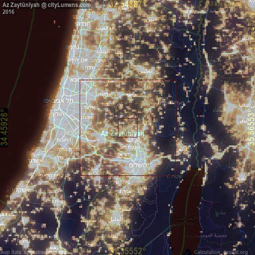
Analysis of Az Zaytūnīyah night lights 2016
Square area 10x10 km:
 5.07%
5.07%90-99
9.79%80-89
16.26%70-79
20.63%60-69
9.97%50-59
15.91%40-49
13.64%30-39
7.52%20-29
1.22%10-19
0%0-9
0%Square area 50x50 km:
10.92%90-99
11.52%80-89
12.28%70-79
10.91%60-69
6.86%50-59
9.53%40-49
10.79%30-39
7.75%20-29
6.14%10-19
5.66%0-9
7.62%Clear (daylight) street map image can be seen on geolist.org.
Map coordinates:
32° 32' 55.2" North, 34° 27' 33.4" East
31° 57' 14.5" North, 35° 9' 44.6" East
31° 21' 19.9" North, 35° 51' 55.9" East
Some cities around Az Zaytūnīyah sort by population:
• Al Bīrah
7.1 km =4.4 mi,  133°
133°
• Ramallah
7.2 km =4.5 mi,  146°
146°
• Baytūnyā
6.4 km =4 mi,  173°
173°
• Givat Zeev
10.3 km =6.4 mi,  176°
176°
• Silwād
9.7 km =6 mi,  75°
75°
• Dayr Dibwān
10.9 km =6.8 mi,  115°
115°
• Bīr Zayt
3.5 km =2.2 mi,  59°
59°
• Banī Zayd ash Shārqīyah
10.6 km =6.6 mi,  1°
1°
285034 (p: 6,107)
Sources (retrieved 2019-11-25):
» Earth at Night: Flat Maps 2012, 2016